College Station
Current Weather
Light Rain
Feels like: 35.2°C (95.4°F)
Sun Schedule
⚠️ Live forecasts now on mobile app only
This page is showing cached weather data. For real-time forecasts and updates for all cities, please download our mobile app:
City Images
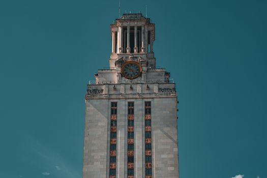
College Station - Photo 1
Photo by Brixiv

College Station - Photo 2
Photo by Bogdan Krupin

College Station - Photo 3
Photo by Bogdan Krupin
College Station, United States
Click any image to view larger versionPast Weather Alerts
5 of 42Freeze Warning
* WHAT...Hard Freeze with temperatures as low as the lower 20s expected outside of urban areas. * W...
Extreme Cold Warning
* WHAT...Dangerously cold wind chills as low as 5 above zero. * WHERE...Central Texas. * WHEN...Un...
Extreme Cold Warning
* WHAT...Dangerously cold temperatures in the single digits and teens. * WHERE...All of south centr...
Extreme Cold Warning
* WHAT...Dangerously cold wind chills as low as 5 to 10. * WHERE...Portions of south central and so...
Extreme Cold Warning
* WHAT...Dangerously cold wind chills as low as 5 degrees below zero possible over parts of the Hill...
Past Weather Alerts for College Station
Freeze Warning
* WHAT...Hard Freeze with temperatures as low as the lower 20s expected outside of urban areas. * WHERE...Portions of south central and southeast Texas. * WHEN...From 9 PM this evening to 9 AM CST Sunday. * IMPACTS...Frost and freeze conditions could kill crops, other sensitive vegetation and possibly damage unprotected outdoor plumbing.
Extreme Cold Warning
* WHAT...Dangerously cold wind chills as low as 5 above zero. * WHERE...Central Texas. * WHEN...Until 9 AM CST Tuesday. * IMPACTS...The cold wind chills as low as 5 above zero could result in hypothermia or frostbite on exposed skin if precautions are not taken.
Extreme Cold Warning
* WHAT...Dangerously cold temperatures in the single digits and teens. * WHERE...All of south central Texas. * WHEN...Until 9 AM CST Tuesday. * IMPACTS...The dangerously cold temperatures could result in hypothermia or frostbite on exposed skin if precautions are not taken. Extreme cold will become life threatening and likely damage unprotected pipes and put livestock at risk.
Extreme Cold Warning
* WHAT...Dangerously cold wind chills as low as 5 to 10. * WHERE...Portions of south central and southeast Texas. * WHEN...Until noon CST Tuesday. * IMPACTS...Frostbite and hypothermia will occur if unprotected skin is exposed to these temperatures. Hard freeze conditions with an extended period of freezing temperatures could cause ruptured water pipes. * ADDITIONAL DETAILS...Though roads are mostly dry, any remaining wet spots will freeze overnight, warranting caution when driving.
Extreme Cold Warning
* WHAT...Dangerously cold wind chills as low as 5 degrees below zero possible over parts of the Hill Country and southern Edwards Plateau late tonight through Monday morning. Forecast wind chills for the rest of the area range from the single digits to the teens. * WHERE...All of South Central Texas. * WHEN...Until noon CST Monday. * IMPACTS...The dangerously cold wind chills as low as 5 degrees below zero could result in hypothermia or frostbite on exposed skin if precautions are not taken. Extreme cold will become life threatening and likely damage unprotected pipes and put livestock at risk.
Extreme Cold Warning
* WHAT...Dangerously cold wind chills as low as 5 below zero. * WHERE...Central Texas * WHEN...Until 9 AM CST Tuesday. * IMPACTS...The dangerously cold wind chills as low as zero could result in hypothermia or frostbite on exposed skin if precautions are not taken.
Extreme Cold Warning
* WHAT...Dangerously cold wind chills as low as 5 below zero. * WHERE...Central Texas * WHEN...Until 9 AM CST Tuesday. * IMPACTS...The dangerously cold wind chills as low as 5 below zero could result in hypothermia or frostbite on exposed skin if precautions are not taken.
Ice Storm Warning
* WHAT...Significant icing expected. Total ice accumulations between two tenths and one half of an inch. Sleet accumulation up to a half inch. * WHERE...A portion of southeast Texas. * WHEN...Until 6 PM CST this evening. * IMPACTS...Travel could be nearly impossible, especially on bridges and overpasses. Power outages and tree damage are possible due to the ice.
Winter Storm Warning
* WHAT...Significant icing expected. Total ice accumulations between one quarter and four tenths of an inch. Total sleet accumulations up to a half inch. * WHERE...Brazos, Burleson, Grimes, Montgomery, and Washington Counties. * WHEN...Until 6 PM CST this evening. * IMPACTS...Travel could be nearly impossible, especially on bridges and overpasses. Power outages and tree damage are possible due to the ice.
Extreme Cold Warning
* WHAT...Dangerously cold wind chills as low as near zero well inland to around 10 degrees along the coast expected, with the lowest values Monday morning. Portions of the Piney Woods and Brazos Valley will remain below freezing through Tuesday morning. * WHERE...Portions of south central and southeast Texas. * WHEN...Until noon CST Tuesday. * IMPACTS...Frostbite and hypothermia will occur if unprotected skin is exposed to these temperatures. Hard freeze conditions with an extended period of freezing temperatures could cause ruptured water pipes.
Winter Storm Warning
* WHAT...Mixed Precipitation. Additional snow and sleet accumulations of up to two tenths of an inch and ice accumulations around a tenth of an inch. * WHERE...Central Texas * WHEN...Until noon CST today. * IMPACTS...The strong winds and weight of snow on tree limbs may down power lines and could cause sporadic power outages. Very slippery sidewalks as well as slick roads, bridges and overpasses are possible. * ADDITIONAL DETAILS...The bulk of the heavy precipitation is coming to an end, however, impacts to travel and infrastructure will continue.
Extreme Cold Warning
* WHAT...Dangerously cold wind chills as low as 5 degrees below zero possible over parts of the Hill Country and southern Edwards Plateau late Saturday night into early Sunday morning and late Sunday evening through Monday morning. Forecast wind chills for the rest of the area range from the single digits to the teens. * WHERE...A portion of south central Texas. * WHEN...From 6 PM this evening to noon CST Monday. * IMPACTS...The dangerously cold wind chills as low as 5 degrees below zero could result in hypothermia or frostbite on exposed skin if precautions are not taken. Extreme cold will become life threatening and likely damage unprotected pipes and put livestock at risk.
Winter Storm Warning
* WHAT...Accumulations of 1/10 to 1/4 inch of ice likely across the warning area. In addition, dangerously cold temperatures are expected Saturday night through Monday morning. * WHERE...Bastrop, Caldwell, Fayette, Lee, and Val Verde Counties. * WHEN...Until noon CST Sunday. * IMPACTS...Roads, especially bridges and overpasses, will likely become slick and hazardous. Weather-related power outages are possible. Extreme cold will become life threatening and likely damage unprotected pipes and put livestock at risk. Travel could be nearly impossible.
Extreme Cold Warning
* WHAT...Dangerously cold wind chills as low as 5 below zero expected. * WHERE...Central Texas. * WHEN...From 6 PM this evening to 9 AM CST Tuesday. * IMPACTS...The dangerously cold wind chills as low as 5 below zero could result in hypothermia or frostbite on exposed skin if precautions are not taken.
Winter Storm Warning
* WHAT...Heavy mixed precipitation. Additional snow and sleet accumulations up to one inch and ice accumulations between one tenth and two tenths of an inch. * WHERE...Portions of Central Texas * WHEN...Until noon CST Sunday. * IMPACTS...The strong winds and weight of snow on tree limbs may down power lines and could cause sporadic power outages. Power outages and tree damage are likely due to the ice. Travel could be nearly impossible.
Extreme Cold Warning
* WHAT...Dangerously cold wind chills as low as 5 below zero well inland to around 10 degrees along the coast expected, with the lowest values Monday morning. Portions of the Piney Woods and Brazos Valley will remain below freezing tonight through Tuesday morning. * WHERE...Portions of south central and southeast Texas. * WHEN...From 6 PM this evening to noon CST Tuesday. * IMPACTS...Frostbite and hypothermia will occur if unprotected skin is exposed to these temperatures. Hard freeze conditions with an extended period of freezing temperatures could cause ruptured water pipes.
Winter Storm Warning
* WHAT...Heavy mixed precipitation expected. Total snow and sleet accumulations up to one and a half inches and ice accumulations between two tenths and four tenths of an inch. * WHERE...Portions of north central and south central Texas. * WHEN...Until noon CST Sunday. * IMPACTS...The strong winds and weight of snow on tree limbs may down power lines and could cause sporadic power outages. Power outages and tree damage are likely due to the ice. Travel could be nearly impossible.
Winter Storm Warning
* WHAT...Accumulations of 1/10 to 1/4 inch of ice likely across the warning area. Isolated amounts of 1/4 to 1/2 inch are possible across the Hill Country. In addition, dangerously cold temperatures are expected Saturday night through Monday morning. * WHERE...A portion of south central Texas. * WHEN...From 3 AM Saturday to noon CST Sunday. * IMPACTS...Roads, especially bridges and overpasses, will likely become slick and hazardous. Weather-related power outages are possible. Extreme cold will become life threatening and likely damage unprotected pipes and put livestock at risk. Travel could be nearly impossible.
Winter Storm Warning
* WHAT...Accumulations of 1/10 to 1/4 inch of ice likely across the warning area. Isolated amounts of 1/4 to 1/2 inch are possible across the Hill Country. In addition, dangerously cold temperatures are expected Saturday night through Monday morning. * WHERE...A portion of south central Texas. * WHEN...From 6 AM Saturday to noon CST Sunday. * IMPACTS...Roads, especially bridges and overpasses, will likely become slick and hazardous. Weather-related power outages are possible. Extreme cold will become life threatening and likely damage unprotected pipes and put livestock at risk. Travel could be nearly impossible. * ADDITIONAL DETAILS...Freezing rain could begin as early as Saturday morning over the Hill Country followed by Saturday afternoon and evening elsewhere.
Extreme Cold Warning
* WHAT...Dangerously cold wind chills as low as 5 below zero expected. * WHERE...Portions of north central, northeast, and south central Texas. * WHEN...From 6 PM Saturday to noon CST Monday. * IMPACTS...The dangerously cold wind chills as low as 5 below zero could result in hypothermia or frostbite on exposed skin if precautions are not taken.
Extreme Cold Warning
* WHAT...Dangerously cold wind chills as low as 5 degrees below zero possible over parts of the Hill Country and southern Edwards Plateau late Saturday night into early Sunday morning and late Sunday evening through Monday morning. Forecast wind chills for the rest of the area range from the single digits to the teens. * WHERE...A portion of south central Texas. * WHEN...From 6 PM Saturday to noon CST Monday. * IMPACTS...Dangerously cold wind chills as low as 5 degrees below zero could result in hypothermia or frostbite on exposed skin if precautions are not taken. Extreme cold will become life threatening and likely damage unprotected pipes and put livestock at risk.
Extreme Cold Warning
* WHAT...For the Extreme Cold Warning, dangerously cold wind chills as low as the single digits below zero. For the Extreme Cold Watch, dangerously cold wind chills as low as the single digits above zero possible. * WHERE...Portions of south central and southeast Texas. * WHEN...For the Extreme Cold Warning, from 6 PM Saturday to noon CST Monday. For the Extreme Cold Watch, from Monday afternoon through Tuesday morning. * IMPACTS...Frostbite and hypothermia will occur if unprotected skin is exposed to these temperatures. Hard freeze conditions with an extended period of freezing temperatures could cause ruptured water pipes.
Winter Storm Warning
* WHAT...Heavy mixed precipitation expected. Total snow and sleet accumulations up to one inch and ice accumulations between one tenth and one quarter of an inch. * WHERE...Brazos, Burleson, Grimes, Montgomery, and Washington Counties. * WHEN...From 6 AM Saturday to 6 PM CST Sunday. * IMPACTS...Power outages and tree damage are likely due to the ice. Travel could be nearly impossible.
Ice Storm Warning
* WHAT...Significant icing expected. Total snow and sleet accumulations up to one inch and ice accumulations between three tenths and one half of an inch. * WHERE...A portion of southeast Texas. * WHEN...From 6 AM Saturday to 6 PM CST Sunday. * IMPACTS...Power outages and tree damage are likely due to the ice. Travel could be nearly impossible.
Extreme Cold Watch
* WHAT...For the Extreme Cold Warning, dangerously cold wind chills as low as the single digits below zero. For the Extreme Cold Watch, dangerously cold wind chills as low as the single digits above zero possible. * WHERE...Portions of south central and southeast Texas. * WHEN...For the Extreme Cold Warning, from 6 PM Saturday to noon CST Monday. For the Extreme Cold Watch, from Monday afternoon through Tuesday morning. * IMPACTS...Frostbite and hypothermia will occur if unprotected skin is exposed to these temperatures. Hard freeze conditions with an extended period of freezing temperatures could cause ruptured water pipes.
Winter Storm Warning
* WHAT...Heavy mixed precipitation expected. Ice accumulations between one quarter and one half of an inch. Total sleet and snow accumulations up to around one inch. * WHERE...Portions of north and central Texas. * WHEN...From 6 AM Saturday to noon CST Sunday. * IMPACTS...The strong winds and weight of snow on tree limbs may down power lines and could cause sporadic power outages. Significant ice accumulation on power lines and tree limbs may cause widespread and long-lasting power outages. Travel could be impossible.
Extreme Cold Warning
* WHAT...For the Extreme Cold Warning, dangerously cold wind chills as low as 5 below zero well inland to around 10 degrees along the coast expected. For the Extreme Cold Watch, dangerously cold wind chills as low as 5 to 15 degrees possible. * WHERE...Portions of south central and southeast Texas. * WHEN...For the Extreme Cold Warning, from 6 PM Saturday to noon CST Monday. For the Extreme Cold Watch, from Monday afternoon through Tuesday morning. * IMPACTS...Frostbite and hypothermia will occur if unprotected skin is exposed to these temperatures. Hard freeze conditions with an extended period of freezing temperatures could cause ruptured water pipes.
Extreme Cold Watch
* WHAT...For the Extreme Cold Warning, dangerously cold wind chills as low as 5 below zero well inland to around 10 degrees along the coast expected. For the Extreme Cold Watch, dangerously cold wind chills as low as 5 to 15 degrees possible. * WHERE...Portions of south central and southeast Texas. * WHEN...For the Extreme Cold Warning, from 6 PM Saturday to noon CST Monday. For the Extreme Cold Watch, from Monday afternoon through Tuesday morning. * IMPACTS...Frostbite and hypothermia will occur if unprotected skin is exposed to these temperatures. Hard freeze conditions with an extended period of freezing temperatures could cause ruptured water pipes.
Winter Storm Warning
* WHAT...Heavy mixed precipitation expected. Total ice accumulations between one tenth and one quarter of an inch. Sleet accumulations less than half an inch. * WHERE...Brazos, Burleson, Grimes, Montgomery, and Washington Counties. * WHEN...From 6 AM Saturday to 6 PM CST Sunday. * IMPACTS...Power outages and tree damage are likely due to the ice. Travel could be nearly impossible.
Ice Storm Warning
* WHAT...Significant icing expected. Total ice accumulations between two tenths and one half of an inch. Sleet accumulation less than a half an inch. * WHERE...A portion of southeast Texas. * WHEN...From 6 AM Saturday to 6 PM CST Sunday. * IMPACTS...Power outages and tree damage are likely due to the ice. Travel could be nearly impossible.
Winter Storm Watch
* WHAT...Heavy mixed precipitation possible. Total ice accumulations between one tenth and three tenths of an inch possible across the entire watch area, with the highest accumulations in the Piney Woods and Brazos Valley. Slight sleet accumulations will be possible in the northern Piney Woods and Brazos Valley, but the primary concern will be freezing rain. * WHERE...A portion of southeast Texas. * WHEN...From Saturday morning through Sunday afternoon. * IMPACTS...Power outages and tree damage are possible due to the ice. Travel could be hazardous. * ADDITIONAL DETAILS...Rain will change over to freezing rain and sleet in the Piney Woods and Brazos Valley as early as midday Saturday. Elsewhere, rain may change over to freezing rain as early as Saturday afternoon or Saturday night.
Extreme Cold Watch
* WHAT...Dangerously cold wind chills as low as -5 to 10 degrees possible. Lowest values in the Piney Woods and Brazos Valley. A hard freeze is also expected Saturday night and Sunday night with lows in the single digits to lower 20s. Some areas north of I-10 may remain below freezing all day on Sunday, and potentially on Monday as well for areas in the Brazos Valley and the Piney Woods. * WHERE...Portions of south central and southeast Texas. * WHEN...From Saturday evening through Monday morning. * IMPACTS...Frostbite and hypothermia will occur if unprotected skin is exposed to these temperatures. An extended period of freezing temperatures could cause ruptured water pipes.
Winter Storm Watch
* WHAT...Heavy mixed precipitation possible. Total snow and sleet accumulations up to one inch and ice accumulations between one tenth and four tenths of an inch possible. * WHERE...A portion of southeast Texas. * WHEN...From Saturday morning through Sunday afternoon. * IMPACTS...Power outages and tree damage are likely due to the ice. Travel could be nearly impossible.
Extreme Cold Watch
* WHAT...Dangerously cold wind chills as low as 5 below zero possible well inland. Even at the coast, wind chills to around 10 degrees above zero are anticipated. * WHERE...Portions of south central and southeast Texas. * WHEN...From Saturday evening through Monday morning. * IMPACTS...Frostbite and hypothermia will occur if unprotected skin is exposed to these temperatures. An extended period of freezing temperatures could cause ruptured water pipes.
Winter Storm Warning
* WHAT...Heavy mixed precipitation expected. Ice accumulations between one quarter of an inch and one half of an inch. Isolated amounts up to three quarters of an inch can't be ruled out, mainly in eastern Central Texas. In addition, sleet and snow accumulations up to one inch are also possible. * WHERE...Central Texas. * WHEN...From 6 AM Saturday to noon CST Sunday. * IMPACTS...The strong winds and weight of snow on tree limbs may down power lines and could cause sporadic power outages. Significant ice accumulation on power lines and tree limbs may cause widespread and long-lasting power outages. Travel could be impossible.
Winter Storm Warning
* WHAT...Accumulations of 1/10 to 1/4 inch of ice likely across the warning area. Isolated amounts of 1/4 to 1/2 inch are possible across the Hill Country. In addition, dangerously cold temperatures are expected Saturday night through Monday morning. * WHERE...A portion of south central Texas. * WHEN...From 6 AM Saturday to noon CST Sunday. * IMPACTS...Travel will be difficult. * ADDITIONAL DETAILS...Freezing rain could begin as early as Saturday morning over the Hill Country and Saturday afternoon and evening elsewhere.
Extreme Cold Warning
* WHAT...For the Dense Fog Advisory, visibility one quarter mile or less in dense fog. For the Extreme Cold Warning, dangerously cold wind chills as low as 5 below zero expected. * WHERE...Bell, Coryell, Lampasas, and Milam Counties. * WHEN...For the Dense Fog Advisory, until 10 AM CST this morning. For the Extreme Cold Warning, from 6 PM Saturday to noon CST Monday. * IMPACTS...The dangerously cold wind chills as low as 5 below zero could result in hypothermia or frostbite on exposed skin if precautions are not taken. Low visibility could make driving conditions hazardous.
Extreme Cold Warning
* WHAT...For the Dense Fog Advisory, visibility one quarter mile or less in dense fog. For the Extreme Cold Warning, as low as 5 degrees below zero possible over parts of the Hill Country and southern Edwards Plateau late Saturday night into early Sunday morning and late Sunday evening through Monday morning. Forecast wind chills for the rest of the area range from the single digits to the teens. * WHERE...For the Dense Fog Advisory, majority of South Central Texas. For the Extreme Cold Warning, all of South Central Texas. * WHEN...For the Dense Fog Advisory, until 10 AM CST this morning. For the Extreme Cold Warning, from 6 PM Saturday to noon CST Monday. * IMPACTS...For the Dense Fog Advisory, Hazardous driving conditions due to low visibility. For the Extreme Cold Warning, dangerously cold wind chills as low as 5 degrees below zero could result in hypothermia or frostbite on exposed skin if precautions are not taken. Extreme cold will become life threatening and likely damage unprotected pipes and put livestock at risk.
Dense Fog Advisory
* WHAT...For the Dense Fog Advisory, visibility one quarter mile or less in dense fog. For the Extreme Cold Warning, as low as 5 degrees below zero possible over parts of the Hill Country and southern Edwards Plateau late Saturday night into early Sunday morning and late Sunday evening through Monday morning. Forecast wind chills for the rest of the area range from the single digits to the teens. * WHERE...For the Dense Fog Advisory, majority of South Central Texas. For the Extreme Cold Warning, all of South Central Texas. * WHEN...For the Dense Fog Advisory, until 10 AM CST this morning. For the Extreme Cold Warning, from 6 PM Saturday to noon CST Monday. * IMPACTS...For the Dense Fog Advisory, Hazardous driving conditions due to low visibility. For the Extreme Cold Warning, dangerously cold wind chills as low as 5 degrees below zero could result in hypothermia or frostbite on exposed skin if precautions are not taken. Extreme cold will become life threatening and likely damage unprotected pipes and put livestock at risk.
Extreme Cold Warning
* WHAT...Dangerously cold wind chills as low as 4 below zero expected. * WHERE...Freestone, Limestone, Navarro, Anderson, Henderson, Leon, Van Zandt, and Robertson Counties. * WHEN...From 6 PM Saturday to noon CST Monday. * IMPACTS...The dangerously cold wind chills as low as 5 below zero could result in hypothermia or frostbite on exposed skin if precautions are not taken.
Dense Fog Advisory
* WHAT...For the Dense Fog Advisory, visibility one quarter mile or less in dense fog. For the Extreme Cold Warning, dangerously cold wind chills as low as 5 below zero expected. * WHERE...Bell, Coryell, Lampasas, and Milam Counties. * WHEN...For the Dense Fog Advisory, until 10 AM CST this morning. For the Extreme Cold Warning, from 6 PM Saturday to noon CST Monday. * IMPACTS...The dangerously cold wind chills as low as 5 below zero could result in hypothermia or frostbite on exposed skin if precautions are not taken. Low visibility could make driving conditions hazardous.
Wind Advisory
* WHAT...North winds 15 to 25 mph with gusts up to 45 mph expected. * WHERE...Austin, Brazos, Burleson, Colorado, Grimes, Madison, Waller, and Washington Counties. * WHEN...From 9 PM this evening to 6 PM CST Monday. * IMPACTS...Gusty winds will blow around unsecured objects. Tree limbs could be blown down and a few power outages may result.