Eau Claire
Current Weather
Light Rain
Feels like: 23.4°C (74.1°F)
Sun Schedule
⚠️ Live forecasts now on mobile app only
This page is showing cached weather data. For real-time forecasts and updates for all cities, please download our mobile app:
City Images

Eau Claire - Photo 1
Photo by Chris Flaten

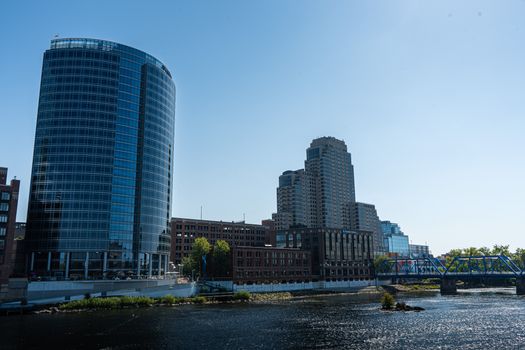
Eau Claire - Photo 2
Photo by Sofía Morales
Eau Claire - Photo 3
Photo by fish socks
Eau Claire, United States
Click any image to view larger versionPast Weather Alerts
5 of 51Special Weather Statement
Very dry relative humidity values between 15 and 25 percent, southwest winds gusting to 30 to 35 mph...
Special Weather Statement
The combination of strong south winds with dry air and parched fuels results in elevated fire weathe...
Special Weather Statement
The combination warmer temperatures into the 50s, low relative humidity values between 20 and 25 per...
Flood Warning
...The Flood Warning is extended for the following rivers in Wisconsin... Black River Near Galesvil...
Flood Warning
...The Flood Warning continues for the following rivers in Wisconsin... Black River Near Galesville...
Past Weather Alerts for Eau Claire
Special Weather Statement
Very dry relative humidity values between 15 and 25 percent, southwest winds gusting to 30 to 35 mph and dry fuels will lead to elevated fire weather conditions across west central Wisconsin this afternoon & early evening. All of these weather elements with the dry fuels will contribute to an increased danger of rapidly spreading fires. Outdoor burning is discouraged under these conditions. Take care to prevent the start of accidental fires when smoking or operating vehicles within or around dry vegetation.
Special Weather Statement
The combination of strong south winds with dry air and parched fuels results in elevated fire weather conditions in west-central and central Wisconsin this afternoon and early evening, primarily near and north of Interstate 90. Minimum relative humidity values of 15 to 25 percent expected with sustained winds of 15 to 25 mph gusting to 35 mph. Under these conditions, fires will start and spread more easily. Please exercise caution with any activities that involve outdoor fires or create sparks, including campfires, grilling, and operating large equipment. Cigarettes should be disposed of and extinguished properly. Please heed any local burn bans.
Special Weather Statement
The combination warmer temperatures into the 50s, low relative humidity values between 20 and 25 percent, southwest winds gusting to 30 to 35 mph and dry fuels will lead to elevated fire weather conditions across west central Wisconsin on Saturday. All of these weather elements with the dry fuels will contribute to an increased danger of rapidly spreading fires. Outdoor burning is discouraged under these conditions. Take care to prevent the start of accidental fires when smoking or operating vehicles within or around dry vegetation.
Flood Warning
...The Flood Warning is extended for the following rivers in Wisconsin... Black River Near Galesville affecting La Crosse and Trempealeau Counties. Yellow River at Necedah affecting Juneau County. * WHAT...Minor flooding is occurring and minor flooding is forecast. * WHERE...Black River near Galesville. * WHEN...From this evening to late tomorrow evening. * IMPACTS...At 12.0 feet, Flooding mainly impacts wildlands and agricultural pasture land. The approaches on both ends of the County Road VV bridge over the Black River in Jackson County may begin to flood and the bridge gates may be closed. * ADDITIONAL DETAILS... - At 8:00 PM CDT Tuesday the stage was 12.2 feet. - Bankfull stage is 10.0 feet. - Recent Activity...The maximum river stage in the 24 hours ending at 8:00 PM CDT Tuesday was 12.2 feet. - Forecast...The river is expected to rise to a crest of 12.3 feet just after midnight tonight. It will then fall below flood stage late tomorrow morning. - Flood stage is 12.0 feet. - Flood History...This crest compares to a previous crest of 12.3 feet on 04/07/1981. - http://www.weather.gov/safety/flood
Flood Warning
...The Flood Warning continues for the following rivers in Wisconsin... Black River Near Galesville affecting Trempealeau and La Crosse Counties. * WHAT...Minor flooding is forecast. * WHERE...Black River near Galesville. * WHEN...From late tonight to early tomorrow afternoon. * IMPACTS...At 12.0 feet, Flooding mainly impacts wildlands and agricultural pasture land. The approaches on both ends of the County Road VV bridge over the Black River in Jackson County may begin to flood and the bridge gates may be closed. * ADDITIONAL DETAILS... - At 9:00 AM CDT Tuesday the stage was 11.1 feet. - Bankfull stage is 10.0 feet. - Forecast...The river is expected to rise to a crest of 12.0 feet just after midnight tonight and then fall. - Flood stage is 12.0 feet. - http://www.weather.gov/safety/flood
Flood Watch
...The National Weather Service in La Crosse WI has issued a Flood Watch for the following rivers in Wisconsin... Black River Near Galesville affecting La Crosse and Trempealeau zones. Yellow River at Necedah affecting Juneau County. .Warm temperatures have melted snowpack and increased river flows. * WHAT...Flooding is possible. * WHERE...Black River near Galesville. * WHEN...From Tuesday afternoon to Wednesday evening. * IMPACTS...At 12.0 feet, flooding mainly impacts wildlands and agricultural pasture land. The approaches on both ends of the County Road VV bridge over the Black River in Jackson County may begin to flood and the bridge gates may be closed. * ADDITIONAL DETAILS... - At 9:00 AM CDT Monday the stage was 8.3 feet. - Forecast...Flood stage may be reached tomorrow afternoon. - Flood stage is 12.0 feet. - http://www.weather.gov/safety/flood
Winter Storm Warning
...POWERFUL WINTER STORM ON TRACK TO BRING EXTREME SNOW ACCUMULATIONS AND GUSTY WINDS... ...TRAVEL MAY BECOME IMPOSSIBLE LATE SATURDAY NIGHT AND SUNDAY... .A major winter storm will move across the Upper Midwest starting late Saturday and lasting through Sunday. The first concern is heavy snow, with a broad area of 10 to 16 inches likely, and a narrow swath of 15 to 20 inches Totals across portions of western and central Wisconsin could approach 2 feet. The heaviest snow will fall Saturday evening and overnight, with rates of 2 inches per hour possible. Winds will start out of the northeast at 20 to 30 mph. The second concern is increasing winds on Sunday. Even though the snow will be diminishing on Sunday, northwest winds will increase to 35 to 45 mph. The combination of heavy snow and gusty winds will reduce visibility and create periods of blizzard conditions on Sunday across western and southern Minnesota. Travel is expected to become very difficult or impossible late Saturday night and Sunday. In addition, the amount of water in the snowpack will make it wet and very heavy, leading to the potential for infrastructure damage and a health hazard for those shoveling. * WHAT...Heavy snow expected. Total snow accumulations between 12 and 18 inches. Winds gusting as high as 40 mph. * WHERE...Chippewa, Dunn, Eau Claire, Pepin, Pierce, and St. Croix Counties. * WHEN...From 7 PM Saturday to 7 AM CDT Monday. * IMPACTS...Travel could be very difficult to impossible. Widespread blowing snow could significantly reduce visibility. The hazardous conditions will impact the Monday morning commute. Gusty winds could bring down tree branches.
Blizzard Warning
...DANGEROUS WINTER STORM TO IMPACT THE REGION THROUGH MONDAY MORNING... .A dangerous and potentially historic winter storm will impact the region through Monday morning. Snow rates north of Interstate 90 will increase throughout the overnight. By early Sunday morning snowfall rates of 2 to 4 inches per hour are likely across portions of northern Clark and Taylor Counties. Mixed precipitation is likely near I-90 Sunday morning where freezing rain accumulations of one to three tenths of an inch of ice is likely. By Sunday afternoon, much of the area will switchover to snow with wind gusts increasing to 35 to 55 mph. This will result in widespread visibilities reductions to 1/4 mile or less at times where the Blizzard Warning is in effect. Storm total snow accumulations will likely approach all-time records in north-central Wisconsin with 18 to 36 inches of snow expected north of Interstate 94. Travel will be impossible for much of the area throughout the storm. Any travel should be reserved for emergencies only. Power outages and tree damage will be possible with the combination of heavy snow, ice, and increasing winds on Sunday. * WHAT...For the Winter Storm Warning, heavy mixed precipitation expected with heavy snow expected north Interstate 94. For the Blizzard Warning, blizzard conditions expected with winds gusting as high as 45 mph. Storm total snow accumulations south of Interstate 94 between 10 and 18 inches and ice accumulations around a light glaze. Storm total snow accumulations north of Interstate 94 of 18 to 36 inches. * WHERE...Clark, Taylor, Buffalo, Jackson, and Trempealeau Counties. * WHEN...For the Winter Storm Warning, until 10 AM CDT Sunday. For the Blizzard Warning, from 10 AM Sunday to 7 AM CDT Monday. * IMPACTS...Travel could be very difficult to impossible. Areas of blowing snow could significantly reduce visibility. The hazardous conditions could impact the Monday morning commute. Gusty winds could bring down tree branches.
Winter Storm Warning
...DANGEROUS WINTER STORM TO IMPACT THE REGION THROUGH MONDAY MORNING... .A dangerous and potentially historic winter storm will impact the region through Monday morning. Snow rates north of Interstate 90 will increase throughout the overnight. By early Sunday morning snowfall rates of 2 to 4 inches per hour are likely across portions of northern Clark and Taylor Counties. Mixed precipitation is likely near I-90 Sunday morning where freezing rain accumulations of one to three tenths of an inch of ice is likely. By Sunday afternoon, much of the area will switchover to snow with wind gusts increasing to 35 to 55 mph. This will result in widespread visibilities reductions to 1/4 mile or less at times where the Blizzard Warning is in effect. Storm total snow accumulations will likely approach all-time records in north-central Wisconsin with 18 to 36 inches of snow expected north of Interstate 94. Travel will be impossible for much of the area throughout the storm. Any travel should be reserved for emergencies only. Power outages and tree damage will be possible with the combination of heavy snow, ice, and increasing winds on Sunday. * WHAT...For the Winter Storm Warning, heavy mixed precipitation expected with heavy snow expected north Interstate 94. For the Blizzard Warning, blizzard conditions expected with winds gusting as high as 45 mph. Storm total snow accumulations south of Interstate 94 between 10 and 18 inches and ice accumulations around a light glaze. Storm total snow accumulations north of Interstate 94 of 18 to 36 inches. * WHERE...Clark, Taylor, Buffalo, Jackson, and Trempealeau Counties. * WHEN...For the Winter Storm Warning, until 10 AM CDT Sunday. For the Blizzard Warning, from 10 AM Sunday to 7 AM CDT Monday. * IMPACTS...Travel could be very difficult to impossible. Areas of blowing snow could significantly reduce visibility. The hazardous conditions could impact the Monday morning commute. Gusty winds could bring down tree branches.
Blizzard Warning
...HISTORIC MARCH WINTER STORM ON TRACK TO BRING EXTREME SNOW ACCUMULATIONS AND STRONG WINDS... ...A WINTRY MIX OF RAIN, FREEZING RAIN, AND SLEET LATE TONIGHT ACROSS SOUTH CENTRAL MINNESOTA... ...TRAVEL MAY BECOME IMPOSSIBLE LATE TONIGHT AND SUNDAY... .A historic March winter storm will move across the Upper Midwest starting this evening and lasting into Sunday night. Heavy snow with a broad area of 12 to 18 inches expected across central Minnesota and western Wisconsin. A narrow swath within the broader area may approach 2 feet in parts of far east central Minnesota and west central Wisconsin. Rates of 2 to 2.5 inches per hour are likely late tonight into Sunday morning. A wintry mix of rain, freezing rain, and sleet is expected to work north into I-90 corridor of southern Minnesota tonight. A half inch of sleet and a tenth of an inch of ice are expected along the I-90 corridor. The wintry mix will turn to all snow Sunday morning. Winds will increase on Sunday. Even though the snow will be tapering off gradually throughout Sunday, northwest winds will increase to 35 to 45 mph. Some gusts of 50 to 55 mph are possible across the Minnesota River Valley. The combination of falling snow, blowing snow, and gusty winds will reduce visibility and create blizzard conditions late tonight through Sunday evening across central and southern Minnesota and western Wisconsin. Travel is expected to become very difficult or impossible late tonight through Sunday evening. In addition, the amount of water in the snowpack will make it very heavy, leading to the potential for infrastructure damage and a health hazard for those shoveling. * WHAT...Blizzard conditions expected. Total snow accumulations between 12 and 20 inches. Winds gusting as high as 45 mph Sunday afternoon and evening. * WHERE...Barron, Polk, Rusk, Chippewa, Dunn, Eau Claire, Pepin, Pierce, and St. Croix Counties. * WHEN...From 1 AM Sunday to 7 AM CDT Monday. * IMPACTS...Travel could be very difficult to impossible. Widespread blowing snow could significantly reduce visibility. The hazardous conditions will impact the Monday morning commute. Gusty winds could bring down tree branches.
Winter Storm Warning
...DANGEROUS WINTER STORM MOVES IN THIS EVENING... .A dangerous and potentially historic winter storm will move into the region this evening and continue through early Monday morning. Snow will move into the region this evening north of Interstate 90 with snowfall rates increasing throughout the overnight. By early Sunday morning snowfall rates of 2 to 4 inches per hour are likely across portions of northern Clark and Taylor Counties. Mixed precipitation is likely near I-90 Sunday morning where freezing rain accumulations of one to three tenths of an inch of ice is likely. By Sunday afternoon, much of the area will switchover to snow with wind gusts increasing to 35 to 50 mph. This will result in widespread visibilities reductions to 1/4 mile or less at times where the Blizzard Warning is in effect. Storm total snow accumulations will likely approach all-time records in north-central Wisconsin with 18 to 36 inches of snow expected north of Interstate 94. Travel will be impossible for much of the area throughout the storm. Any travel should be reserved for emergencies only. Power outages and tree damage will be possible with the combination of heavy snow, ice, and increasing winds on Sunday. * WHAT...For the Winter Storm Warning, heavy mixed precipitation expected with heavy snow expected north Interstate 94. For the Blizzard Warning, blizzard conditions expected with winds gusting as high as 45 mph. Storm total snow accumulations south of Interstate 94 between 10 and 18 inches and ice accumulations around a light glaze. Storm total snow accumulations north of Interstate 94 of 18 to 36 inches. * WHERE...Clark, Taylor, Buffalo, Jackson, and Trempealeau Counties. * WHEN...For the Winter Storm Warning, from 7 PM this evening to 10 AM CDT Sunday. For the Blizzard Warning, from 10 AM Sunday to 7 AM CDT Monday. * IMPACTS...Travel could be very difficult to impossible. Areas of blowing snow could significantly reduce visibility. The hazardous conditions could impact the Monday morning commute. Gusty winds could bring down tree branches.
Blizzard Warning
...DANGEROUS WINTER STORM MOVES IN THIS EVENING... .A dangerous and potentially historic winter storm will move into the region this evening and continue through early Monday morning. Snow will move into the region this evening north of Interstate 90 with snowfall rates increasing throughout the overnight. By early Sunday morning snowfall rates of 2 to 4 inches per hour are likely across portions of northern Clark and Taylor Counties. Mixed precipitation is likely near I-90 Sunday morning where freezing rain accumulations of one to three tenths of an inch of ice is likely. By Sunday afternoon, much of the area will switchover to snow with wind gusts increasing to 35 to 50 mph. This will result in widespread visibilities reductions to 1/4 mile or less at times where the Blizzard Warning is in effect. Storm total snow accumulations will likely approach all-time records in north-central Wisconsin with 18 to 36 inches of snow expected north of Interstate 94. Travel will be impossible for much of the area throughout the storm. Any travel should be reserved for emergencies only. Power outages and tree damage will be possible with the combination of heavy snow, ice, and increasing winds on Sunday. * WHAT...For the Winter Storm Warning, heavy mixed precipitation expected with heavy snow expected north Interstate 94. For the Blizzard Warning, blizzard conditions expected with winds gusting as high as 45 mph. Storm total snow accumulations south of Interstate 94 between 10 and 18 inches and ice accumulations around a light glaze. Storm total snow accumulations north of Interstate 94 of 18 to 36 inches. * WHERE...Clark, Taylor, Buffalo, Jackson, and Trempealeau Counties. * WHEN...For the Winter Storm Warning, from 7 PM this evening to 10 AM CDT Sunday. For the Blizzard Warning, from 10 AM Sunday to 7 AM CDT Monday. * IMPACTS...Travel could be very difficult to impossible. Areas of blowing snow could significantly reduce visibility. The hazardous conditions could impact the Monday morning commute. Gusty winds could bring down tree branches.
Wind Advisory
* WHAT...West to northwest winds 20 to 30 mph with gusts up to 55 mph expected. * WHERE...Portions of central, north central, southwest, and west central Wisconsin. * WHEN...From midnight tonight to 1 PM CDT Friday. * IMPACTS...Gusty winds will blow around unsecured objects. Tree limbs could be blown down and a few power outages may result. * ADDITIONAL DETAILS...Any snow that occurs with these winds will quickly lead to whiteout conditions and make travel very difficult.
Wind Advisory
* WHAT...Northwest winds 25 to 35 mph with gusts up to 50 mph expected. * WHERE...In Minnesota, Chisago, Isanti, Kanabec, and Mille Lacs Counties. In Wisconsin, Barron, Polk, Chippewa, Dunn, Eau Claire, Pepin, Pierce, and St. Croix Counties. * WHEN...From midnight tonight to 10 AM CDT Friday. * IMPACTS...Gusty winds will blow around unsecured objects. Tree limbs could be blown down and a few power outages may result.
Wind Advisory
* WHAT...West winds 20 to 30 mph with gusts up to 50 mph expected. * WHERE...Portions of central, north central, southwest, and west central Wisconsin. * WHEN...From midnight Thursday Night to 1 PM CDT Friday. * IMPACTS...Gusty winds will blow around unsecured objects. Tree limbs could be blown down and a few power outages may result.
Wind Advisory
* WHAT...West winds 25 to 35 mph with gusts up to 50 mph expected. * WHERE...Chippewa, Dunn, Eau Claire, Pepin, Pierce, and St. Croix Counties. * WHEN...From midnight Thursday Night to 10 AM CDT Friday. * IMPACTS...Gusty winds will blow around unsecured objects. Tree limbs could be blown down and a few power outages may result.
Winter Weather Advisory
...SNOW AND BLOWING SNOW EXPECTED IN CENTRAL WISCONSIN... .A winter storm will move through northern Wisconsin tonight into Friday morning bringing snow to areas along and north of US Highway 10 in central Wisconsin with expected amounts rising rapidly north of Wisconsin Highway 29. With wind gusts ramping up overnight to 45 to 50 mph by Friday morning, unsheltered areas will see blowing and drifting leading to hazardous driving conditions. Light snow and blowing snow are expected to linger through the morning before winds begin decreasing during Friday afternoon. * WHAT...Snow expected. Total snow accumulations up to 3 inches. Winds gusting as high as 50 mph. * WHERE...Clark County. * WHEN...From 7 PM this evening to 1 PM CDT Friday. * IMPACTS...Plan on slippery road conditions. The hazardous conditions could impact the Friday morning commute. Gusty winds could bring down tree branches.
Winter Weather Advisory
...ACCUMULATING SNOW ACROSS WESTERN WISCONSIN TONIGHT INTO WEDNESDAY MORNING... .Light rain this afternoon transitions over to snow through this evening, with snowfall accumulations up to 3-4" expected across western Wisconsin through Wednesday morning. Snow will be ongoing during the morning commute along & north of the Interstate 94 corridor, leading to slow & slippery travel overnight through the morning hours. * WHAT...Snow expected. Total snow accumulations between 2 and 4 inches. * WHERE...Chippewa, Dunn, Eau Claire, and St. Croix Counties. * WHEN...From 11 PM this evening to 1 PM CDT Wednesday. * IMPACTS...Plan on slippery road conditions. The hazardous conditions will impact the Wednesday morning commute.
Dense Fog Advisory
* WHAT...Visibility one quarter mile or less in dense fog. * WHERE...In Minnesota, Sherburne, Wright, Anoka, Chisago, Hennepin, Isanti, Ramsey, and Washington Counties. In Wisconsin, Polk, Pierce, and St. Croix Counties. * WHEN...Until 10 AM CST this morning. * IMPACTS...Low visibility could make driving conditions hazardous.
Winter Weather Advisory
...MODERATE TO HEAVY SNOW TONIGHT INTO FRIDAY MORNING... .A winter storm lifts through the region tonight and exits Friday morning. The band of heaviest snow amounts is expected to be 30 to 40 miles at most and has shifted northwestward slightly over the last few hours. The winter storm warnings and advisories have been adjusted accordingly. There will be a very sharp cutoff in amounts on the northwest side of the snow band with impacts varying greatly in the span of just a few miles. Road conditions will deteriorate quickly in the band of heavy snow with slippery to hazardous travel conditions expected. * WHAT...Snow with accumulations up to 3 inches. Winds gusting as high as 35 mph. * WHERE...In Iowa, Mitchell County. In Minnesota, Fillmore and Winona Counties. In Wisconsin, Jackson and Trempealeau Counties. * WHEN...Until 9 AM CST Friday. * IMPACTS...Plan on slippery road conditions. The hazardous conditions could impact the Friday morning commute. * ADDITIONAL DETAILS...There will be a sharp cutoff in snow amounts across the advisory with the northwestward sections of counties in the advisory possibly getting little to no snow.
Winter Weather Advisory
...BAND OF ACCUMULATING SNOW CONTINUES OVER PORTIONS OF WESTERN, CENTRAL, AND EASTERN MINNESOTA INTO WESTERN WISCONSIN TONIGHT... * WHAT...Snow. Additional snow accumulations up to two inches possible. * WHERE...Portions of central, east central, south central, and southeast Minnesota and west central Wisconsin. * WHEN...Until 3 AM CST Thursday. * IMPACTS...Roads, and especially bridges and overpasses, will likely become slick and hazardous. Plan on slippery road conditions.
Winter Weather Advisory
...BANDS OF HEAVY SNOW CONTINUE TO LIFT NORTH OVER SOUTHERN AND EASTERN MINNESOTA INTO WESTERN WISCONSIN THIS EVENING... .Snow continues across southern and eastern Minnesota into western Wisconsin. Bands of snow, some heavy at times, will result in travel impacts through this evening. A Winter Weather Advisory remains in effect south of I-94 and north and east of the Minnesota River in Minnesota. In addition, a Winter Weather Advisory remains in effect for portions of western Wisconsin, mainly surrounding the I-94 corridor as travel conditions have deteriorated. * WHAT...Snow. Additional snow accumulations up to 2 inches. Winds gusting as high as 40 mph. * WHERE...Portions of central, east central, south central, and southeast Minnesota and west central Wisconsin. * WHEN...Until 9 PM CST this evening. * IMPACTS...Plan on slippery road conditions. The hazardous conditions will impact the Wednesday evening commute. * ADDITIONAL DETAILS...The combination of gusty winds and falling snow will reduce visibility and cause slippery travel.
Cold Weather Advisory
* WHAT...Very cold wind chills as low as 25 to 35 below expected. * WHERE...Portions of north central and northeast Iowa, southeast Minnesota, and central, north central, southwest, and west central Wisconsin. * WHEN...From midnight tonight to noon CST Monday. * IMPACTS...The dangerously cold wind chills as low as 25 to 35 below zero could cause frostbite on exposed skin in as little as 10 minutes.
Cold Weather Advisory
* WHAT...Very cold wind chills as low as 35 below expected. * WHERE...Portions of east central, south central, and southeast Minnesota and northwest and west central Wisconsin. * WHEN...From midnight tonight to noon CST Monday. * IMPACTS...The cold wind chills as low as 35 below zero could cause frostbite on exposed skin in as little as 10 minutes. Frostbite and hypothermia will occur if unprotected skin is exposed to these temperatures.
Cold Weather Advisory
* WHAT...Very cold wind chills as low as 35 below. * WHERE...Clark and Taylor Counties. * WHEN...Until 9 AM CST Saturday. * IMPACTS...The dangerously cold wind chills as low as 35 below zero could cause frostbite on exposed skin in as little as 10 minutes.
Cold Weather Advisory
* WHAT...Very cold wind chills as low as 30 below expected today. Air temperatures of 26 to 31 below zero expected tonight. * WHERE...In Minnesota, Benton, Morrison, Todd, Chisago, Isanti, Kanabec, Mille Lacs, and Douglas Counties. In Wisconsin, Barron, Polk, Rusk, Chippewa, Dunn, Eau Claire, and St. Croix Counties. * WHEN...Until 9 AM CST Saturday. * IMPACTS...The dangerously cold wind chills as low as 35 below zero could cause frostbite on exposed skin in as little as 10 minutes. Frostbite and hypothermia will occur if unprotected skin is exposed to these temperatures.
Cold Weather Advisory
* WHAT...Very cold wind chills as low as 35 below expected today. Air temperatures of 25 to 30 below zero expected tonight. * WHERE...In Minnesota, Benton, Morrison, Todd, Chisago, Isanti, Kanabec, Mille Lacs, and Douglas Counties. In Wisconsin, Barron, Polk, Rusk, Chippewa, Dunn, Eau Claire, and St. Croix Counties. * WHEN...Until 9 AM CST Saturday. * IMPACTS...Frostbite and hypothermia will occur if unprotected skin is exposed to these temperatures. The dangerously cold wind chills as low as 35 below zero could cause frostbite on exposed skin in as little as 10 minutes.
Cold Weather Advisory
* WHAT...Very cold wind chills as low as 30 below expected. * WHERE...Portions of central, east central, south central, southeast, southwest, and west central Minnesota and west central Wisconsin. * WHEN...Until midnight CST tonight. * IMPACTS...The cold wind chills as low as 35 below zero could cause frostbite on exposed skin in as little as 10 minutes.
Cold Weather Advisory
* WHAT...Very cold wind chills as low as 30 below. * WHERE...Portions of central, east central, south central, and southeast Minnesota and west central Wisconsin. * WHEN...Until midnight CST tonight. * IMPACTS...The cold wind chills as low as 30 below zero could cause frostbite on exposed skin in as little as 10 minutes. Frostbite and hypothermia will occur if unprotected skin is exposed to these temperatures.
Cold Weather Advisory
* WHAT...For the Extreme Cold Warning, dangerously cold wind chills as low as 39 below. For the Cold Weather Advisory, very cold wind chills as low as 35 below expected. * WHERE...Buffalo, Jackson, and Trempealeau Counties. * WHEN...For the Extreme Cold Warning, until noon CST today. For the Cold Weather Advisory, until midnight CST tonight. * IMPACTS...The dangerously cold wind chills as low as 40 below zero could cause frostbite on exposed skin in as little as 10 minutes.
Cold Weather Advisory
* WHAT...For the Extreme Cold Warning, dangerously cold wind chills as low as 42 below. For the Cold Weather Advisory, very cold wind chills as low as 35 below expected. * WHERE...Clark and Taylor Counties. * WHEN...For the Extreme Cold Warning, until noon CST today. For the Cold Weather Advisory, until 9 AM CST Saturday. * IMPACTS...The dangerously cold wind chills as low as 40 below zero could cause frostbite on exposed skin in as little as 10 minutes.
Cold Weather Advisory
* WHAT...Very cold wind chills as low as 30 below. * WHERE...Clark and Taylor Counties. * WHEN...Until 10 AM CST Tuesday. * IMPACTS...The dangerously cold wind chills as low as 30 below zero could cause frostbite on exposed skin in as little as 30 minutes.
Cold Weather Advisory
* WHAT...Very cold wind chills as low as 35 below expected. * WHERE...Barron, Polk, Rusk, Chippewa, Dunn, Eau Claire, Pepin, Pierce, and St. Croix Counties. * WHEN...From 3 AM to noon CST Monday. * IMPACTS...The cold wind chills as low as 35 below zero could cause frostbite on exposed skin in as little as 10 minutes.
Dense Fog Advisory
* WHAT...Visibility 1/2 mile or less in dense fog. * WHERE...In Minnesota, Wabasha County. In Wisconsin, Buffalo, Jackson, and Trempealeau Counties. * WHEN...Until 10 AM CST this morning. * IMPACTS...Low visibility could make driving conditions hazardous.
Dense Fog Advisory
* WHAT...Visibility 1/4 mile or less in dense fog. * WHERE...Clark and Taylor Counties. * WHEN...Until 10 AM CST this morning. * IMPACTS...Low visibility could make driving conditions hazardous.
Dense Fog Advisory
* WHAT...Areas of dense fog and freezing fog with visibility as low as one quarter mile. * WHERE...Portions of central, east central, south central, southeast, and west central Minnesota and northwest and west central Wisconsin. * WHEN...Until 9 AM CST this morning. * IMPACTS...Low visibility could make driving conditions hazardous. Freezing fog may deposit onto untreated or lesser traveled roads, bridges and overpasses, creating slippery spots.
Dense Fog Advisory
* WHAT...Visibility one quarter mile or less in dense fog. * WHERE...In Minnesota, Chisago County. In Wisconsin, Barron, Polk, Rusk, and Chippewa Counties. * WHEN...Until noon CST Tuesday. * IMPACTS...Low visibility could make driving conditions hazardous.
Winter Weather Advisory
* WHAT...Freezing rain expected. Total ice accumulations between one tenth and two tenths of an inch. * WHERE...Dunn, Eau Claire, Pepin, Pierce, and St. Croix Counties. * WHEN...Until noon CST Tuesday. * IMPACTS...Difficult travel conditions are possible. The hazardous conditions will impact the Tuesday morning commute.
Winter Weather Advisory
* WHAT...Freezing rain expected. Total ice accumulations up to two tenths of an inch. * WHERE...In Minnesota, Chisago County. In Wisconsin, Barron, Polk, Rusk, and Chippewa Counties. * WHEN...From 3 AM to noon CST Tuesday. * IMPACTS...Difficult travel conditions are possible. The hazardous conditions will impact the Tuesday morning commute.
Winter Weather Advisory
* WHAT...Freezing rain expected. Total ice accumulations between one tenth and two tenths of an inch. * WHERE...Barron, Polk, Rusk, Chippewa, Dunn, Eau Claire, Pepin, Pierce, and St. Croix Counties. * WHEN...From 9 PM this evening to noon CST Tuesday. * IMPACTS...Difficult travel conditions are possible. The hazardous conditions could impact the Tuesday morning commute.
Winter Weather Advisory
...FREEZING RAIN MAY RESULT IN SLICK TRAVEL FOR SOME THROUGH TUESDAY MORNING... .A band of rain and freezing rain stretches from southeast Minnesota into west-central Wisconsin. This precipitation expands in area through the rest of the night and into the morning hours, a period which may bring the heaviest amounts of icing along a broad line from Red Wing, MN to Wisconsin Rapids, WI. The band of heaviest icing will be narrow in nature, possibly only 10-15 miles wide. Ice amounts within this narrow corridor could be around 0.1 to 0.2", possibly even higher in a few select spots. These conditions will impact the Tuesday morning commute. * WHAT...Freezing rain expected with total ice accumulations up to one to two tenths of an inch, likely in a very narrow band and dependent heavily on the exact surface temperature. * WHERE...Portions of southeast Minnesota and central and west central Wisconsin. * WHEN...Until noon CST Tuesday. * IMPACTS...Difficult travel conditions are possible. The hazardous conditions could impact the Tuesday morning commute.
Winter Weather Advisory
* WHAT...Freezing rain expected. Total ice accumulations up to two tenths of an inch. * WHERE...Barron, Polk, Rusk, Chippewa, Dunn, Eau Claire, Pepin, Pierce, and St. Croix Counties. * WHEN...From 9 PM this evening to noon CST Tuesday. * IMPACTS...Difficult travel conditions are possible. The hazardous conditions will impact the Tuesday morning commute.