Long Sault
Current Weather
Scattered Clouds
Feels like: 23.1°C (73.6°F)
Sun Schedule
⚠️ Live forecasts now on mobile app only
This page is showing cached weather data. For real-time forecasts and updates for all cities, please download our mobile app:
City Images
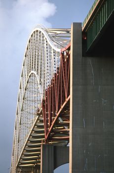
Long Sault - Photo 1
Photo by Michael Hamments

Long Sault - Photo 2
Photo by Yajun Dong

Long Sault - Photo 3
Photo by Yajun Dong
Long Sault, Canada
Click any image to view larger versionPast Weather Alerts
5 of 62weather
Freezing rain and rain expected Tuesday. What: Extended period of freezing rain or freezing drizzle...
weather
Freezing rain and rain expected Tuesday. What: Extended period of freezing rain or freezing drizzle...
weather
Snow, possibly becoming mixed with freezing rain tonight. What: Total snowfall amounts of 5 to 12 c...
weather
Snow and reduced visibilities. What : Snowfall amounts of 5 to 10 cm. Reduced visibilities in areas...
weather
###
Past Weather Alerts for Long Sault
weather
Freezing rain and rain expected Tuesday. What: Extended period of freezing rain or freezing drizzle. Rain with amounts in the 15 to 25 mm range possible. When: Beginning early Tuesday morning and ending early Wednesday morning. Additional information: A Colorado Low is expected to bring freezing rain, freezing drizzle and rain to the region. There remains considerable uncertainty regarding the track and some of the details of this system. At this point, it appears entirely possible that the precipitation could arrive in two waves with a break for several hours on Tuesday. During this break, the freezing rain may stop or change to freezing drizzle. The location of the band of freezing rain could also shift significantly should the track of this system change. Temperatures are likely to rise above the freezing mark on Tuesday in some areas outside of the Ottawa River Valley, changing the freezing rain to rain. Untreated roads may become icy and slippery. Motorists should allow extra time to get to their destination. Power outages are possible. ### Please continue to monitor alerts and forecasts issued by Environment Canada. To report severe weather, send an email to ONstorm@ec.gc.ca or post reports on X using #QCStorm.
weather
Freezing rain and rain expected Tuesday. What: Extended period of freezing rain or freezing drizzle. Rain with amounts in the 20 to 40 mm range possible. When: Beginning early Tuesday morning and ending early Wednesday morning. Additional information: A Colorado Low is expected to bring freezing rain, freezing drizzle and rain to the region. There remains considerable uncertainty regarding the track and some of the details of this system. At this point, it appears entirely possible that the precipitation could arrive in two waves with a break for several hours on Tuesday. During this break, the freezing rain may stop or change to freezing drizzle. The location of the band of freezing rain could also shift significantly should the track of this system change. Temperatures are likely to rise above the freezing mark on Tuesday in some areas outside of the Ottawa River Valley, changing the freezing rain to rain. Untreated roads may become icy and slippery. Motorists should allow extra time to get to their destination. Power outages are possible. For information concerning flooding, please consult your local Conservation Authority or Ontario Ministry of Natural Resources office. Visit Ontario.ca/floods for the latest details. ### Please continue to monitor alerts and forecasts issued by Environment Canada. To report severe weather, send an email to ONstorm@ec.gc.ca or post reports on X using #ONStorm.
weather
Snow, possibly becoming mixed with freezing rain tonight. What: Total snowfall amounts of 5 to 12 cm. Reduced visibility in heavy snow. Risk of freezing rain. When: Tonight through Sunday morning. Additional information: An Alberta Clipper is spreading snow across the region. The snow may become mixed with freezing rain or freezing drizzle tonight before coming to an end Sunday morning. Roads and walkways may be difficult to navigate due to accumulating snow. Untreated roads may become icy and slippery. Motorists should allow extra time to get to their destination. ### Please continue to monitor alerts and forecasts issued by Environment Canada. To report severe weather, send an email to ONstorm@ec.gc.ca or post reports on X using #ONStorm.
weather
Snow and reduced visibilities. What : Snowfall amounts of 5 to 10 cm. Reduced visibilities in areas with heavier snowfall. When : Continuing until mid-afternoon. Additional information: Some areas could get localized bursts of heavy snowfall. In general snow will taper off to flurries from west to east through the morning. Roads and walkways will likely be difficult to navigate due to accumulating snow. Prepared for deteriorating travel conditions. Allow extra time for travel. ### Please continue to monitor alerts and forecasts issued by Environment Canada. To report severe weather, send an email to ONstorm@ec.gc.ca or post reports on X using #ONStorm.
weather
###
weather
Snow this morning. What: Snowfall amounts of 5 to 10 cm. Reduced visibility in areas of heavier snow. When: Continuing through this morning. Additional information: Some areas could get localized bursts of heavy snowfall. In general snow will taper off to flurries from west to east through the morning. Roads and walkways will likely be difficult to navigate due to accumulating snow. Prepare for deteriorating travel conditions. Allow extra time for travel. ### Please continue to monitor alerts and forecasts issued by Environment Canada. To report severe weather, send an email to ONstorm@ec.gc.ca or post reports on X using #QCStorm.
weather
Snow early this morning. What: Snowfall amounts of 5 to 10 cm. Reduced visibility in areas of heavier snow. When: Early this morning. Additional information: Some locales could get enhanced snowfall from lake Ontario. Snow will taper off to flurries this morning. Roads and walkways will likely be difficult to navigate due to accumulating snow. Prepare for deteriorating travel conditions. Allow extra time for travel. ### Please continue to monitor alerts and forecasts issued by Environment Canada. To report severe weather, send an email to ONstorm@ec.gc.ca or post reports on X using #QCStorm.
weather
Snow expected today. What: Snowfall amounts near 10 cm. Reduced visibility in heavy snow. When: Beginning this afternoon. Tapering off late this evening or overnight. Additional information: Roads and walkways will likely be difficult to navigate due to accumulating snow. Allow extra time for travel. If driving, turn on your lights, slow down and maintain a safe following distance. ### Please continue to monitor alerts and forecasts issued by Environment Canada. To report severe weather, send an email to ONstorm@ec.gc.ca or post reports on X using #ONStorm.
weather
Snow expected today. What: Snowfall amounts near 10 cm. Reduced visibility in heavy snow. When: Beginning this afternoon. Tapering off late this evening or overnight. Additional information: Snow may mix with ice pellets at times for some locations near the St. Lawrence River Valley. Roads and walkways will likely be difficult to navigate due to accumulating snow. Allow extra time for travel. If driving, turn on your lights, slow down and maintain a safe following distance. ### Please continue to monitor alerts and forecasts issued by Environment Canada. To report severe weather, send an email to ONstorm@ec.gc.ca or post reports on X using #ONStorm.
snowfall
Significant snow is expected today. What: Snowfall amounts near 15 cm. Reduced visibility in heavy snow. When: Beginning late this morning or early this afternoon. Tapering off this evening. Additional information: Snow may mix with ice pellet in some areas, especially in the vicinity of Brockville, and possibly reducing the total snowfall amounts. ### There may be a significant impact on rush hour traffic. Visibility will likely be reduced at times. Please continue to monitor alerts and forecasts issued by Environment Canada. To report severe weather, send an email to ONstorm@ec.gc.ca or post reports on X using #ONStorm.
Winter Weather Advisory
* WHAT...Snow expected. Total snow accumulations between 4 and 7 inches. * WHERE...Portions of northern New York and Vermont. * WHEN...From 10 AM Friday to 10 AM EST Saturday. * IMPACTS...Travel could be very difficult. The hazardous conditions will likely impact the Friday evening commute. * ADDITIONAL DETAILS...Snow will expand from southwest to northeast during the day. Precipitation may begin as mixed rain and snow in localized areas, especially in the southern St. Lawrence and Champlain Valleys. Snowfall rates will likely exceed 1 inch per hour at times soon after precipitation begins. Snow will trend lighter and become increasingly dry Friday night into Saturday.
fog
Near zero visibility in fog is expected. Fog banks are affecting portions of the region. Fog should dissipate later this morning. ### Travel will likely be hazardous in some locations. Visibility will likely be suddenly reduced at times. Please continue to monitor alerts and forecasts issued by Environment Canada. To report severe weather, send an email to ONstorm@ec.gc.ca or post reports on X using #QCStorm.
fog
Near zero visibility in fog is expected. Fog banks are affecting portions of the region. Fog should dissipate later this morning. ### Travel will likely be hazardous in some locations. Visibility will likely be suddenly reduced at times. Please continue to monitor alerts and forecasts issued by Environment Canada. To report severe weather, send an email to ONstorm@ec.gc.ca or post reports on X using #ONStorm.
Winter Storm Warning
* WHAT...Heavy snow. Additional snow accumulations up to three inches for a storm total of 7 to 16 inches. * WHERE...All of northern New York and Vermont. * WHEN...Until 1 AM EST Tuesday. * IMPACTS...Roads, and especially bridges and overpasses, will likely remain slick and hazardous. Travel could be very difficult. The hazardous conditions will impact the evening commute.
Winter Storm Warning
* WHAT...Heavy snow. Additional snow accumulations between 3 and 7 inches for a storm total of 7 to 16 inches, locally up to 18 possible along the southern spine of the Greens. * WHERE...All of northern New York and Vermont * WHEN...Until 1 AM EST Tuesday. * IMPACTS...Roads, and especially bridges and overpasses, will likely become slick and hazardous. Travel could be very difficult to impossible. The hazardous conditions will impact the morning and evening commutes. * ADDITIONAL DETAILS...Wind chills in the St. Lawrence Valley will remain about 15 below much of the night and early this morning. With the potential for locally 18 inches, like in southern Vermont, ensure adequate ventilation when heating homes or using generators to avoid carbon monoxide risks.
snowfall
Snow, at times heavy, through this morning. What: Snowfall amounts of 10 to 15 cm. Reduced visibility in heavy snow and local blowing snow. When: Continuing through this morning. Additional information: Snow will taper to periods of light snow or flurries from west to east through this morning. The morning commute may be impacted. Northeasterly winds gusting 40 to 50 km/h may result in local blowing snow, particularly for exposed areas. ### Travel will likely be challenging. Roads and walkways will likely be difficult to navigate due to accumulating snow. Please continue to monitor alerts and forecasts issued by Environment Canada. To report severe weather, send an email to ONstorm@ec.gc.ca or post reports on X using #QCStorm. For more information about the alerting program, please visit: https://www.canada.ca/en/services/environment/weather/severeweather/weather-alerts/colour-coded-alerts.
snowfall
Snow, at times heavy, tonight through Monday morning. What: Snowfall amounts of 10 to 20 cm. Reduced visibility in heavy snow and local blowing snow. When: Continuing through Monday morning. Additional information: Snow will taper to periods of light snow or flurries from west to east through Monday morning. The Monday morning commute may be impacted. Northeasterly winds gusting 40 to 50 km/h may result in local blowing snow, particularly for exposed areas. ### Travel will likely be challenging. Roads and walkways will likely be difficult to navigate due to accumulating snow. Please continue to monitor alerts and forecasts issued by Environment Canada. To report severe weather, send an email to ONstorm@ec.gc.ca or post reports on X using #QCStorm. For more information about the alerting program, please visit: https://www.canada.ca/en/services/environment/weather/severeweather/weather-alerts/colour-coded-alerts.
snowfall
Snow, at times heavy, this afternoon through Monday morning. What: Snowfall amounts of 10 to 20 cm. Reduced visibility in heavy snow and local blowing snow. When: This afternoon through Monday morning. Additional information: Snow will taper to periods of light snow or flurries from west to east through Monday morning. The Monday morning commute may be impacted. Northeasterly winds gusting 40 to 50 km/h may result in local blowing snow, particularly for exposed areas. ### Travel will likely be challenging. Roads and walkways will likely be difficult to navigate due to accumulating snow. Please continue to monitor alerts and forecasts issued by Environment Canada. To report severe weather, send an email to ONstorm@ec.gc.ca or post reports on X using #QCStorm. For more information about the alerting program, please visit: https://www.canada.ca/en/services/environment/weather/severeweather/weather-alerts/colour-coded-alerts.
Winter Storm Warning
* WHAT...Heavy snow expected. Total snow accumulations between 8 and 16 inches. Total snow accumulations for parts of southeastern Essex County, New York and southern and central Vermont between 13 and 19 inches, locally up to 2 feet possible along the southern Greens. * WHERE...All of northern New York and Vermont. * WHEN...Until 1 AM EST Tuesday. * IMPACTS...Roads, and especially bridges and overpasses, will likely become slick and hazardous. Travel could be very difficult to impossible. The hazardous conditions will impact the Monday morning and evening commutes. * ADDITIONAL DETAILS...Snowfall rates are likely to exceed one inch per hour this evening into the overnight hours in the Adirondacks and much of Vermont. With the potential for locally 18 inches of greater, like in southern Vermont, ensure adequate ventilation when heating homes or using generators to avoid carbon monoxide risks.
snow squall
Snow squalls continuing this evening. What: Brief periods of near zero visibility in heavy snow and blowing snow. When: This evening. Additional information: Significantly reduced visibility will be the primary concern as opposed to snowfall accumulation. Southwesterly winds gusting up to 70 km/h will result in blowing snow. The possibility of blowing snow may persist into the overnight. ### Travel will likely be hazardous. Visibility will likely be suddenly reduced to near zero at times. There may be a significant impact on rush hour traffic. Please continue to monitor alerts and forecasts issued by Environment Canada. To report severe weather, send an email to ONstorm@ec.gc.ca or post reports on X using #ONStorm. For more information about the alerting program, please visit: https://www.canada.ca/en/services/environment/weather/severeweather/weather-alerts/colour-coded-alerts.
snow squall
Snow squalls continuing this evening. What: Brief periods of near zero visibility in heavy snow and blowing snow. Additional snowfall amounts up to 5 cm. When: This evening. Additional information: Significantly reduced visibility will be the primary concern as opposed to snowfall accumulation. Southwesterly winds gusting up to 70 km/h will result in blowing snow. The possibility of blowing snow may persist into the overnight. ### Travel will likely be hazardous. Visibility will likely be suddenly reduced to near zero at times. There may be a significant impact on rush hour traffic. Please continue to monitor alerts and forecasts issued by Environment Canada. To report severe weather, send an email to ONstorm@ec.gc.ca or post reports on X using #ONStorm. For more information about the alerting program, please visit: https://www.canada.ca/en/services/environment/weather/severeweather/weather-alerts/colour-coded-alerts.
snow squall
Snow squalls are no longer expected. ###
weather
Strong winds expected late this afternoon and evening. What: Strong winds with gusts of 70 to 90 km/h. When: Late this afternoon through this evening. Additional information: Winds will strengthen and suddenly shift to the west late this afternoon or early this evening as a cold front passes, with a brief gust to 90 km/h possible. Winds will ease this evening. Local utility outages are possible. Secure loose objects. ### Please continue to monitor alerts and forecasts issued by Environment Canada. To report severe weather, send an email to ONstorm@ec.gc.ca or post reports on X using #QCStorm. For more information about the alerting program, please visit: https://www.canada.ca/en/services/environment/weather/severeweather/weather-alerts/colour-coded-alerts.
Wind Advisory
* WHAT...Southwest winds 15 to 25 mph with gusts up to 55 mph. * WHERE...Northern Franklin, Southeastern St. Lawrence, Southern Franklin, and Western Clinton Counties. * WHEN...Until 1 AM EST Saturday. * IMPACTS...Gusty winds will blow around unsecured objects. Tree limbs could be blown down and isolated power outages may result. * ADDITIONAL DETAILS...Strongest gusts likely between 7 PM and 1 AM. Locally higher gusts are possible along US Route 11 near Malone and Chateaugay.
Wind Advisory
* WHAT...South winds 15 to 25 mph with gusts up to 55 mph expected. * WHERE...Northern St. Lawrence and Southwestern St. Lawrence Counties. * WHEN...Until 10 PM EST this evening. * IMPACTS...Gusty winds will blow around unsecured objects. Tree limbs could be blown down and isolated outages may result. * ADDITIONAL DETAILS...Strongest wind gusts are most likely between 7 PM and 1 AM immediately behind a cold front.
weather
Strong winds expected this afternoon. What: Strong winds with gusts of 70 to 90 km/h. When: This afternoon and easing this evening. Additional information: Showers will push through the region this morning. These showers will have the potential to generate strong wind gusts near 70 km/h. A cold front is then expected to push through the region this afternoon or early this evening. The passage of the cold front may lead to another wave of strong winds with the potential for wind gusts of 70 to 90 km/h. The winds will ease from west to east this evening. ### Please continue to monitor alerts and forecasts issued by Environment Canada. To report severe weather, send an email to ONstorm@ec.gc.ca or post reports on X using #QCStorm. For more information about the alerting program, please visit: https://www.canada.ca/en/services/environment/weather/severeweather/weather-alerts/colour-coded-alerts.
Wind Advisory
* WHAT...Southwest winds 15 to 25 mph with gusts up to 50 mph expected. * WHERE...St. Lawrence Valley. * WHEN...From 2 PM this afternoon to 10 PM EST this evening. * IMPACTS...Gusty winds will blow around unsecured objects. Tree limbs could be blown down and a few power outages may result. * ADDITIONAL DETAILS...Strongest wind gusts are most likely during the evening hours along and immediately behind a cold front.
Wind Advisory
* WHAT...Southwest winds 15 to 30 mph with gusts up to 55 mph expected. * WHERE...Franklin and Western Clinton Counties in New York. * WHEN...From 10 AM this morning to 1 AM EST Saturday. * IMPACTS...Gusty winds will blow around unsecured objects. Tree limbs could be blown down and a few power outages may result. * ADDITIONAL DETAILS...The strongest wind gusts will likely be in the vicinity of the Route 11 corridor north of the Adirondacks.
Wind Advisory
* WHAT...Southwest winds 15 to 25 mph with gusts up to 50 mph expected. * WHERE...Southeastern St. Lawrence County. * WHEN...From 10 AM this morning to 1 AM EST Saturday. * IMPACTS...Gusty winds will blow around unsecured objects. Tree limbs could be blown down and a few power outages may result.
Winter Weather Advisory
* WHAT...Mixed precipitation expected. Ice accumulations up to around one tenth of an inch and snow accumulations between 1 and 3 inches. * WHERE...Franklin and St. Lawrence Counties. * WHEN...From 4 PM this afternoon to 5 AM EST Wednesday. * IMPACTS...Plan on slippery road conditions. The hazardous conditions could impact the Tuesday evening commute.
Winter Weather Advisory
* WHAT...Mixed precipitation. Additional snow accumulations up to one inch and ice accumulations around one tenth of an inch. * WHERE...Franklin and St. Lawrence Counties in northern New York. * WHEN...Until 5 AM EST early this morning. * IMPACTS...Plan on slippery road conditions. The hazardous conditions could impact the morning commute today.
snow squall
Snow squalls possible. What: Local snowfall amounts of 5 to 10 cm. Reduced visibility in heavy snow and local blowing snow. When: This afternoon through this evening. Additional information: Snow squalls are expected to move into the area from the south this afternoon and continue through this evening. Travel along the 401 corridor will be particularly impacted. For road conditions and other traveller information from the Ministry of Transportation, visit https://www.ontario.ca/511, https://www.twitter.com/511Ontario, or call 5-1-1. ### Visibility may be suddenly reduced to near zero at times. Roads and walkways may be very difficult to navigate due to accumulating snow. Please continue to monitor alerts and forecasts issued by Environment Canada. To report severe weather, send an email to ONstorm@ec.gc.ca or post reports on X using #ONStorm. For more information about the alerting program, please visit: https://www.canada.ca/en/services/environment/weather/severeweather/weather-alerts/colour-coded-alerts.
Winter Storm Warning
* WHAT...Heavy snow. Additional snow accumulations between 1 and 3 inches for a storm total of 5 to 9 inches. * WHERE...Southwestern St. Lawrence County. * WHEN...Until 7 AM EST this morning. * IMPACTS...Visibilities may drop below 1/4 mile due to falling and blowing snow. Plan on slippery road conditions. Areas of blowing snow could significantly reduce visibility. The hazardous conditions could impact holiday travel.
Winter Storm Warning
* WHAT...Heavy snow and lake effect expected. Total snow accumulations between 5 and 9 inches. * WHERE...Southwestern St. Lawrence County. * WHEN...From 4 PM this afternoon to 7 AM EST Thursday. * IMPACTS...Visibilities may drop below 1/4 mile due to falling and blowing snow. Travel could be very difficult. The hazardous conditions could impact holiday travel.
Winter Weather Advisory
* WHAT...Snow. Additional snow accumulations between 1 and 3 inches for a storm total of 3 to 6 inches. * WHERE...Franklin, Northern St. Lawrence, and Southeastern St. Lawrence Counties. * WHEN...Until 7 AM EST this morning. * IMPACTS...Plan on slippery road conditions. Areas of blowing snow could significantly reduce visibility. The hazardous conditions could impact holiday travel.
Winter Weather Advisory
* WHAT...Snow expected. Total snow accumulations between 3 and 6 inches. * WHERE...Northern Franklin, Northern St. Lawrence, Southeastern St. Lawrence, and Southern Franklin Counties. * WHEN...From 4 PM this afternoon to 7 AM EST Thursday. * IMPACTS...Plan on slippery road conditions and periods of poor visibility. The hazardous conditions could impact holiday travel.
snow squall
### Travel will likely be hazardous. Visibility will likely be suddenly reduced to near zero at times. Roads and walkways will likely be difficult to navigate due to accumulating snow. Please continue to monitor alerts and forecasts issued by Environment Canada. To report severe weather, send an email to ONstorm@ec.gc.ca or post reports on X using #ONStorm. For more information about the alerting program, please visit: https://www.canada.ca/en/services/environment/weather/severeweather/weather-alerts/colour-coded-alerts.
snow squall
Snowsqualls expected. What: Local snowfall amounts of 10 to 20 cm. Reduced visibility in heavy snow and local blowing snow. When: Early tonight. Additional information: Snow squalls have moved into the region from Lake Ontario. Travel along the Highway 401 corridor will be particularly hazardous. For road conditions and other traveller information from the Ministry of Transportation, visit https://www.ontario.ca/511, https://www.twitter.com/511Ontario, or call 5-1-1. ### Travel will likely be hazardous. Visibility will likely be suddenly reduced to near zero at times. Roads and walkways will likely be difficult to navigate due to accumulating snow. Please continue to monitor alerts and forecasts issued by Environment Canada. To report severe weather, send an email to ONstorm@ec.gc.ca or post reports on X using #ONStorm. For more information about the alerting program, please visit: https://www.canada.ca/en/services/environment/weather/severeweather/weather-alerts/colour-coded-alerts.
snow squall
###
Winter Weather Advisory
* WHAT...Snow expected. Total snow accumulations between 2 and 6 inches. * WHERE...Franklin and St. Lawrence Counties of New York. * WHEN...From 4 PM this afternoon to 7 AM EST Thursday. * IMPACTS...Plan on slippery road conditions and periods of poor visibility. The hazardous conditions could impact the Wednesday evening and Thursday morning commutes. * ADDITIONAL DETAILS...Snow may be heavy at times late this evening, especially between 8 PM and 1 AM.
weather
Strong winds expected today into tonight. What: Strong northwesterly and southwesterly wind gusts up 70 km/h. When: Beginning later this morning and easing tonight. Additional information. Southwesterly winds are expected to develop this morning with the passage of a strong cold front. The winds will become northwesterly through the afternoon. The winds will ease tonight. Significant ice build-up from freezing rain is expected to lead to more impacts from these winds. Utility outages are possible. Property and tree damage is also possible. ### Please continue to monitor alerts and forecasts issued by Environment Canada. To report severe weather, send an email to ONstorm@ec.gc.ca or post reports on X using #QCStorm. For more information about the alerting program, please visit: https://www.canada.ca/en/services/environment/weather/severeweather/weather-alerts/colour-coded-alerts.
weather
Strong winds expected on Monday. What: Strong northwesterly wind gusts up 70 km/h. Southwesterly wind gusts of 50 to 60 km/h. When: Beginning near midday Monday and easing Monday night. Additional information. Southwesterly winds are expected to develop Monday morning with the passage of a strong cold front. The winds will become northwesterly through the afternoon. The winds will ease through Monday night. Areas with significant ice build-up from freezing rain will be most vulnerable. ### Please continue to monitor alerts and forecasts issued by Environment Canada. To report severe weather, send an email to ONstorm@ec.gc.ca or post reports on X using #QCStorm. For more information about the alerting program, please visit: https://www.canada.ca/en/services/environment/weather/severeweather/weather-alerts/colour-coded-alerts.