Cedar Key
Current Weather
Light Rain
Feels like: 30.5°C (86.9°F)
Sun Schedule
⚠️ Live forecasts now on mobile app only
This page is showing cached weather data. For real-time forecasts and updates for all cities, please download our mobile app:
City Images
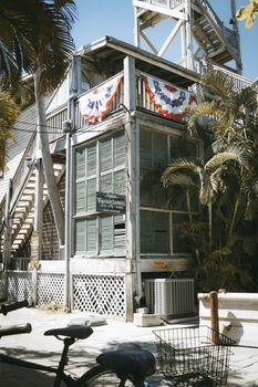
Cedar Key - Photo 1
Photo by PeopleByOwen

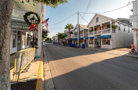
Cedar Key - Photo 2
Photo by Arian Fernandez
Cedar Key - Photo 3
Photo by Dominik Gryzbon
Cedar Key, United States
Click any image to view larger versionPast Weather Alerts
5 of 70Dense Fog Advisory
* WHAT...Visibility one quarter mile or less in dense fog. * WHERE...Portions of Big Bend and Panha...
Dense Fog Advisory
* WHAT...Visibility one quarter mile or less in dense fog. * WHERE...Portions of northeast and nort...
Cold Weather Advisory
* WHAT...For the Freeze Warning, sub-freezing temperatures as low as 26 expected. For the Cold Weath...
Frost Advisory
* WHAT...For the Freeze Warning, sub-freezing temperatures as low as 26 expected. For the Cold Weath...
Freeze Warning
* WHAT...For the Freeze Warning, sub-freezing temperatures as low as 26 expected. For the Cold Weath...
Past Weather Alerts for Cedar Key
Dense Fog Advisory
* WHAT...Visibility one quarter mile or less in dense fog. * WHERE...Portions of Big Bend and Panhandle Florida and south central and southwest Georgia. * WHEN...Until 10 AM EDT /9 AM CDT/ this morning. * IMPACTS...Low visibility could make driving conditions hazardous.
Dense Fog Advisory
* WHAT...Visibility one quarter mile or less in dense fog. * WHERE...Portions of northeast and northern Florida and southeast Georgia. * WHEN...Until 9 AM EDT this morning. * IMPACTS...Low visibility could make driving conditions hazardous.
Cold Weather Advisory
* WHAT...For the Freeze Warning, sub-freezing temperatures as low as 26 expected. For the Cold Weather Advisory, very cold wind chills as low as 24 expected. For the Frost Advisory, temperatures as low as 32 will result in frost formation. * WHERE...Portions of southwest and west central Florida. * WHEN...For the Freeze Warning and Cold Weather Advisory, from 3 AM to 9 AM EST Tuesday. For the Frost Advisory, from 2 AM to 8 AM EST Wednesday. * IMPACTS...Frost and freeze conditions could kill crops, other sensitive vegetation and possibly damage unprotected outdoor plumbing. Frost could harm sensitive outdoor vegetation. Sensitive outdoor plants may be killed if left uncovered.
Frost Advisory
* WHAT...For the Freeze Warning, sub-freezing temperatures as low as 26 expected. For the Cold Weather Advisory, very cold wind chills as low as 24 expected. For the Frost Advisory, temperatures as low as 32 will result in frost formation. * WHERE...Portions of southwest and west central Florida. * WHEN...For the Freeze Warning and Cold Weather Advisory, from 3 AM to 9 AM EST Tuesday. For the Frost Advisory, from 2 AM to 8 AM EST Wednesday. * IMPACTS...Frost and freeze conditions could kill crops, other sensitive vegetation and possibly damage unprotected outdoor plumbing. Frost could harm sensitive outdoor vegetation. Sensitive outdoor plants may be killed if left uncovered.
Freeze Warning
* WHAT...For the Freeze Warning, sub-freezing temperatures as low as 26 expected. For the Cold Weather Advisory, very cold wind chills as low as 24 expected. For the Frost Advisory, temperatures as low as 32 will result in frost formation. * WHERE...Portions of southwest and west central Florida. * WHEN...For the Freeze Warning and Cold Weather Advisory, from 3 AM to 9 AM EST Tuesday. For the Frost Advisory, from 2 AM to 8 AM EST Wednesday. * IMPACTS...Frost and freeze conditions could kill crops, other sensitive vegetation and possibly damage unprotected outdoor plumbing. Frost could harm sensitive outdoor vegetation. Sensitive outdoor plants may be killed if left uncovered.
Dense Fog Advisory
* WHAT...Visibility one-quarter mile or less in dense fog. * WHERE...Coastal Bay, Coastal Dixie, Coastal Franklin, Coastal Jefferson, Coastal Taylor, Coastal Wakulla, Coastal Gulf, and South Walton Counties. * WHEN...Until 9 AM EST /8 AM CST/ Saturday. * IMPACTS...Low visibility could make driving conditions hazardous.
Dense Fog Advisory
* WHAT...Visibility one quarter mile or less in dense fog. * WHERE...Coastal Bay, Coastal Dixie, Coastal Franklin, Coastal Jefferson, Coastal Taylor, Coastal Wakulla, Coastal Gulf, and South Walton Counties. * WHEN...Until 11 AM EST /10 AM CST/ Friday. * IMPACTS...Low visibility could make driving conditions hazardous.
Wind Advisory
* WHAT...For the Extreme Cold Warning tonight, dangerously cold wind chills as low as 8. For the Freeze Warning tonight, sub-freezing temperatures as low as 20. For the Wind Advisory, northwest winds 15 to 25 mph with gusts up to 35 mph. For the Freeze Warning Sunday night, sub-freezing temperatures as low as 20 expected. For the Cold Weather Advisory, very cold wind chills as low as 18 expected. * WHERE...Portions of southwest and west central Florida. * WHEN...For the Extreme Cold Warning and Freeze Warning tonight, valid until 10 AM EST Sunday. For the Wind Advisory, valid until 7 AM EST Sunday. For the Freeze Warning Sunday night, valid from 7 PM Sunday to 9 AM EST Monday. For the Cold Weather Advisory Sunday night, valid from 7 PM Sunday to 10 AM EST Monday. * IMPACTS...Gusty winds will blow around unsecured objects. Tree limbs could be blown down and a few power outages may result. Frost and freeze conditions could kill crops, other sensitive vegetation and possibly damage unprotected outdoor plumbing.
Cold Weather Advisory
* WHAT...For the Extreme Cold Warning tonight, dangerously cold wind chills as low as 8. For the Freeze Warning tonight, sub-freezing temperatures as low as 20. For the Wind Advisory, northwest winds 15 to 25 mph with gusts up to 35 mph. For the Freeze Warning Sunday night, sub-freezing temperatures as low as 20 expected. For the Cold Weather Advisory, very cold wind chills as low as 18 expected. * WHERE...Portions of southwest and west central Florida. * WHEN...For the Extreme Cold Warning and Freeze Warning tonight, valid until 10 AM EST Sunday. For the Wind Advisory, valid until 7 AM EST Sunday. For the Freeze Warning Sunday night, valid from 7 PM Sunday to 9 AM EST Monday. For the Cold Weather Advisory Sunday night, valid from 7 PM Sunday to 10 AM EST Monday. * IMPACTS...Gusty winds will blow around unsecured objects. Tree limbs could be blown down and a few power outages may result. Frost and freeze conditions could kill crops, other sensitive vegetation and possibly damage unprotected outdoor plumbing.
Freeze Warning
* WHAT...For the Extreme Cold Warning tonight, dangerously cold wind chills as low as 8. For the Freeze Warning tonight, sub-freezing temperatures as low as 20. For the Wind Advisory, northwest winds 15 to 25 mph with gusts up to 35 mph. For the Freeze Warning Sunday night, sub-freezing temperatures as low as 20 expected. For the Cold Weather Advisory, very cold wind chills as low as 18 expected. * WHERE...Portions of southwest and west central Florida. * WHEN...For the Extreme Cold Warning and Freeze Warning tonight, valid until 10 AM EST Sunday. For the Wind Advisory, valid until 7 AM EST Sunday. For the Freeze Warning Sunday night, valid from 7 PM Sunday to 9 AM EST Monday. For the Cold Weather Advisory Sunday night, valid from 7 PM Sunday to 10 AM EST Monday. * IMPACTS...Gusty winds will blow around unsecured objects. Tree limbs could be blown down and a few power outages may result. Frost and freeze conditions could kill crops, other sensitive vegetation and possibly damage unprotected outdoor plumbing.
Extreme Cold Warning
* WHAT...For the Extreme Cold Warning tonight, dangerously cold wind chills as low as 8. For the Freeze Warning tonight, sub-freezing temperatures as low as 20. For the Wind Advisory, northwest winds 15 to 25 mph with gusts up to 35 mph. For the Freeze Warning Sunday night, sub-freezing temperatures as low as 20 expected. For the Cold Weather Advisory, very cold wind chills as low as 18 expected. * WHERE...Portions of southwest and west central Florida. * WHEN...For the Extreme Cold Warning and Freeze Warning tonight, valid until 10 AM EST Sunday. For the Wind Advisory, valid until 7 AM EST Sunday. For the Freeze Warning Sunday night, valid from 7 PM Sunday to 9 AM EST Monday. For the Cold Weather Advisory Sunday night, valid from 7 PM Sunday to 10 AM EST Monday. * IMPACTS...Gusty winds will blow around unsecured objects. Tree limbs could be blown down and a few power outages may result. Frost and freeze conditions could kill crops, other sensitive vegetation and possibly damage unprotected outdoor plumbing.
Freeze Warning
* WHAT...For the Extreme Cold Warning, dangerously cold wind chills as low as 6 above. For the first Freeze Warning for a hard freeze, sub-freezing temperatures as low as 19. For the Cold Weather Advisory, very cold wind chills as low as 16 expected. For the second Freeze Warning for a hard freeze, sub-freezing temperatures as low as 22 expected. * WHERE...Portions of Big Bend and Panhandle Florida and south central and southwest Georgia. * WHEN...For the Extreme Cold Warning, until 1 PM EST /noon CST/ Sunday. For the first Freeze Warning, until 10 AM EST /9 AM CST/ Sunday. For the Cold Weather Advisory, from 8 PM EST /7 PM CST/ Sunday to 10 AM EST /9 AM CST/ Monday. For the second Freeze Warning, from midnight EST /11 PM CST/ Sunday Night to 9 AM EST /8 AM CST/ Monday. * IMPACTS...Frost and freeze conditions could kill crops, other sensitive vegetation and possibly damage unprotected outdoor plumbing.
Cold Weather Advisory
* WHAT...For the Extreme Cold Warning, dangerously cold wind chills as low as 10 above. For the Freeze Warning for a hard freeze, sub-freezing temperatures as low as 21. For the Wind Advisory, northwest winds 10 to 20 mph with gusts up to 40 mph. For the Cold Weather Advisory, very cold wind chills as low as 19 expected. * WHERE...Coastal Dixie, Coastal Franklin, Coastal Jefferson, Coastal Taylor, and Coastal Wakulla Counties. * WHEN...For the Extreme Cold Warning, until 1 PM EST Sunday. For the Freeze Warning and Wind Advisory, until 10 AM EST Sunday. For the Cold Weather Advisory, from 8 PM Sunday to 10 AM EST Monday. * IMPACTS...Gusty winds will blow around unsecured objects. Tree limbs could be blown down and a few power outages may result. Frost and freeze conditions could kill crops, other sensitive vegetation and possibly damage unprotected outdoor plumbing.
Cold Weather Advisory
* WHAT...For the Extreme Cold Warning, dangerously cold wind chills as low as 6 above. For the first Freeze Warning for a hard freeze, sub-freezing temperatures as low as 19. For the Cold Weather Advisory, very cold wind chills as low as 16 expected. For the second Freeze Warning for a hard freeze, sub-freezing temperatures as low as 22 expected. * WHERE...Portions of Big Bend and Panhandle Florida and south central and southwest Georgia. * WHEN...For the Extreme Cold Warning, until 1 PM EST /noon CST/ Sunday. For the first Freeze Warning, until 10 AM EST /9 AM CST/ Sunday. For the Cold Weather Advisory, from 8 PM EST /7 PM CST/ Sunday to 10 AM EST /9 AM CST/ Monday. For the second Freeze Warning, from midnight EST /11 PM CST/ Sunday Night to 9 AM EST /8 AM CST/ Monday. * IMPACTS...Frost and freeze conditions could kill crops, other sensitive vegetation and possibly damage unprotected outdoor plumbing.
Wind Advisory
* WHAT...For the Extreme Cold Warning, dangerously cold wind chills as low as 10 above. For the Freeze Warning for a hard freeze, sub-freezing temperatures as low as 21. For the Wind Advisory, northwest winds 10 to 20 mph with gusts up to 40 mph. For the Cold Weather Advisory, very cold wind chills as low as 19 expected. * WHERE...Coastal Dixie, Coastal Franklin, Coastal Jefferson, Coastal Taylor, and Coastal Wakulla Counties. * WHEN...For the Extreme Cold Warning, until 1 PM EST Sunday. For the Freeze Warning and Wind Advisory, until 10 AM EST Sunday. For the Cold Weather Advisory, from 8 PM Sunday to 10 AM EST Monday. * IMPACTS...Gusty winds will blow around unsecured objects. Tree limbs could be blown down and a few power outages may result. Frost and freeze conditions could kill crops, other sensitive vegetation and possibly damage unprotected outdoor plumbing.
Extreme Cold Warning
* WHAT...For the Extreme Cold Warning, dangerously cold wind chills as low as 6 above. For the first Freeze Warning for a hard freeze, sub-freezing temperatures as low as 19. For the Cold Weather Advisory, very cold wind chills as low as 16 expected. For the second Freeze Warning for a hard freeze, sub-freezing temperatures as low as 22 expected. * WHERE...Portions of Big Bend and Panhandle Florida and south central and southwest Georgia. * WHEN...For the Extreme Cold Warning, until 1 PM EST /noon CST/ Sunday. For the first Freeze Warning, until 10 AM EST /9 AM CST/ Sunday. For the Cold Weather Advisory, from 8 PM EST /7 PM CST/ Sunday to 10 AM EST /9 AM CST/ Monday. For the second Freeze Warning, from midnight EST /11 PM CST/ Sunday Night to 9 AM EST /8 AM CST/ Monday. * IMPACTS...Frost and freeze conditions could kill crops, other sensitive vegetation and possibly damage unprotected outdoor plumbing.
Freeze Warning
* WHAT...For the Extreme Cold Warning, dangerously cold wind chills as low as 10 above. For the Freeze Warning for a hard freeze, sub-freezing temperatures as low as 21. For the Wind Advisory, northwest winds 10 to 20 mph with gusts up to 40 mph. For the Cold Weather Advisory, very cold wind chills as low as 19 expected. * WHERE...Coastal Dixie, Coastal Franklin, Coastal Jefferson, Coastal Taylor, and Coastal Wakulla Counties. * WHEN...For the Extreme Cold Warning, until 1 PM EST Sunday. For the Freeze Warning and Wind Advisory, until 10 AM EST Sunday. For the Cold Weather Advisory, from 8 PM Sunday to 10 AM EST Monday. * IMPACTS...Gusty winds will blow around unsecured objects. Tree limbs could be blown down and a few power outages may result. Frost and freeze conditions could kill crops, other sensitive vegetation and possibly damage unprotected outdoor plumbing.
Freeze Warning
* WHAT...For the Wind Advisory, northwest winds 20 to 30 mph with gusts up to 35 mph expected. For the Extreme Cold Warning, dangerously cold wind chills as low as 8 expected. For the Freeze Warning, a hard freeze with temperatures as low as 20 expected. * WHERE...Portions of southwest and west central Florida. * WHEN...For the Wind Advisory, from 3 PM Saturday to 7 AM EST Sunday. For the Extreme Cold Warning and Freeze Warning, from 10 PM Saturday to 10 AM EST Sunday. * IMPACTS...Gusty winds will blow around unsecured objects. Tree limbs could be blown down and a few power outages may result. The dangerously cold wind chills as low as 8 above zero could cause frostbite on exposed skin in as little as 30 minutes. Frostbite and hypothermia will occur if unprotected skin is exposed to these temperatures. An extended period of freezing temperatures could cause ruptured water pipes. Appropriate action should be taken to ensure tender vegetation and outdoor pets have adequate protection from the cold temperatures. Young children, the elderly and the homeless are especially vulnerable to the cold. Take measures to protect them.
Extreme Cold Warning
* WHAT...For the Wind Advisory, northwest winds 20 to 30 mph with gusts up to 35 mph expected. For the Extreme Cold Warning, dangerously cold wind chills as low as 8 expected. For the Freeze Warning, a hard freeze with temperatures as low as 20 expected. * WHERE...Portions of southwest and west central Florida. * WHEN...For the Wind Advisory, from 3 PM Saturday to 7 AM EST Sunday. For the Extreme Cold Warning and Freeze Warning, from 10 PM Saturday to 10 AM EST Sunday. * IMPACTS...Gusty winds will blow around unsecured objects. Tree limbs could be blown down and a few power outages may result. The dangerously cold wind chills as low as 8 above zero could cause frostbite on exposed skin in as little as 30 minutes. Frostbite and hypothermia will occur if unprotected skin is exposed to these temperatures. An extended period of freezing temperatures could cause ruptured water pipes. Appropriate action should be taken to ensure tender vegetation and outdoor pets have adequate protection from the cold temperatures. Young children, the elderly and the homeless are especially vulnerable to the cold. Take measures to protect them.
Wind Advisory
* WHAT...For the Wind Advisory, northwest winds 20 to 30 mph with gusts up to 35 mph expected. For the Extreme Cold Warning, dangerously cold wind chills as low as 8 expected. For the Freeze Warning, a hard freeze with temperatures as low as 20 expected. * WHERE...Portions of southwest and west central Florida. * WHEN...For the Wind Advisory, from 3 PM Saturday to 7 AM EST Sunday. For the Extreme Cold Warning and Freeze Warning, from 10 PM Saturday to 10 AM EST Sunday. * IMPACTS...Gusty winds will blow around unsecured objects. Tree limbs could be blown down and a few power outages may result. The dangerously cold wind chills as low as 8 above zero could cause frostbite on exposed skin in as little as 30 minutes. Frostbite and hypothermia will occur if unprotected skin is exposed to these temperatures. An extended period of freezing temperatures could cause ruptured water pipes. Appropriate action should be taken to ensure tender vegetation and outdoor pets have adequate protection from the cold temperatures. Young children, the elderly and the homeless are especially vulnerable to the cold. Take measures to protect them.
Extreme Cold Warning
* WHAT...For the Freeze Warning, sub-freezing temperatures as low as 19 expected. For the Extreme Cold Warning, dangerously cold wind chills as low as 7 above expected. * WHERE...Portions of northeast and northern Florida and southeast Georgia. * WHEN...For the Freeze Warning, from 7 PM this evening to 11 AM EST Sunday. For the Extreme Cold Warning, from 9 PM this evening to 10 AM EST Sunday. * IMPACTS...The dangerously cold wind chills as low as 5 above zero could cause frostbite on exposed skin in as little as 30 minutes. Appropriate action should be taken to ensure tender vegetation and outdoor pets have adequate protection from the cold temperatures. Young children, the elderly and the homeless are especially vulnerable to the cold. Take measures to protect them.
Freeze Warning
* WHAT...For the Freeze Warning, sub-freezing temperatures as low as 19 expected. For the Extreme Cold Warning, dangerously cold wind chills as low as 7 above expected. * WHERE...Portions of northeast and northern Florida and southeast Georgia. * WHEN...For the Freeze Warning, from 7 PM this evening to 11 AM EST Sunday. For the Extreme Cold Warning, from 9 PM this evening to 10 AM EST Sunday. * IMPACTS...The dangerously cold wind chills as low as 5 above zero could cause frostbite on exposed skin in as little as 30 minutes. Appropriate action should be taken to ensure tender vegetation and outdoor pets have adequate protection from the cold temperatures. Young children, the elderly and the homeless are especially vulnerable to the cold. Take measures to protect them.
Extreme Cold Warning
* WHAT...For the Extreme Cold Warning, dangerously cold wind chills as low as 5 above expected. For the Hard Freeze Warning, sub-freezing temperatures as low as 19 expected. * WHERE...Portions of Big Bend Florida and south central Georgia. * WHEN...For the Extreme Cold Warning, from 1 PM this afternoon to 1 PM EST Sunday. For the Hard Freeze Warning, from 7 PM this evening to 10 AM EST Sunday. * IMPACTS...Frost and freeze conditions could kill crops, other sensitive vegetation and possibly damage unprotected outdoor plumbing.
Extreme Cold Warning
* WHAT...For the Wind Advisory, northwest winds 15 to 25 mph with gusts up to 40 mph expected. For the Extreme Cold Warning, dangerously cold wind chills as low as 8 above expected. For the Hard Freeze Warning, sub-freezing temperatures as low as 19 expected. * WHERE...Coastal Dixie, Coastal Franklin, Coastal Jefferson, Coastal Taylor, and Coastal Wakulla Counties. * WHEN...For the Wind Advisory, from 7 AM this morning to 10 AM EST Sunday. For the Extreme Cold Warning, from 1 PM this afternoon to 1 PM EST Sunday. For the Hard Freeze Warning, from 7 PM this evening to 10 AM EST Sunday. * IMPACTS...Gusty winds will blow around unsecured objects. Tree limbs could be blown down and a few power outages may result. Frost and freeze conditions could kill crops, other sensitive vegetation and possibly damage unprotected outdoor plumbing.
Freeze Warning
* WHAT...For the Extreme Cold Warning, dangerously cold wind chills as low as 5 above expected. For the Hard Freeze Warning, sub-freezing temperatures as low as 19 expected. * WHERE...Portions of Big Bend Florida and south central Georgia. * WHEN...For the Extreme Cold Warning, from 1 PM this afternoon to 1 PM EST Sunday. For the Hard Freeze Warning, from 7 PM this evening to 10 AM EST Sunday. * IMPACTS...Frost and freeze conditions could kill crops, other sensitive vegetation and possibly damage unprotected outdoor plumbing.
Freeze Warning
* WHAT...For the Wind Advisory, northwest winds 15 to 25 mph with gusts up to 40 mph expected. For the Extreme Cold Warning, dangerously cold wind chills as low as 8 above expected. For the Hard Freeze Warning, sub-freezing temperatures as low as 19 expected. * WHERE...Coastal Dixie, Coastal Franklin, Coastal Jefferson, Coastal Taylor, and Coastal Wakulla Counties. * WHEN...For the Wind Advisory, from 7 AM this morning to 10 AM EST Sunday. For the Extreme Cold Warning, from 1 PM this afternoon to 1 PM EST Sunday. For the Hard Freeze Warning, from 7 PM this evening to 10 AM EST Sunday. * IMPACTS...Gusty winds will blow around unsecured objects. Tree limbs could be blown down and a few power outages may result. Frost and freeze conditions could kill crops, other sensitive vegetation and possibly damage unprotected outdoor plumbing.
Wind Advisory
* WHAT...For the Wind Advisory, northwest winds 15 to 25 mph with gusts up to 40 mph expected. For the Extreme Cold Warning, dangerously cold wind chills as low as 8 above expected. For the Hard Freeze Warning, sub-freezing temperatures as low as 19 expected. * WHERE...Coastal Dixie, Coastal Franklin, Coastal Jefferson, Coastal Taylor, and Coastal Wakulla Counties. * WHEN...For the Wind Advisory, from 7 AM this morning to 10 AM EST Sunday. For the Extreme Cold Warning, from 1 PM this afternoon to 1 PM EST Sunday. For the Hard Freeze Warning, from 7 PM this evening to 10 AM EST Sunday. * IMPACTS...Gusty winds will blow around unsecured objects. Tree limbs could be blown down and a few power outages may result. Frost and freeze conditions could kill crops, other sensitive vegetation and possibly damage unprotected outdoor plumbing.
Extreme Cold Warning
* WHAT...For the Extreme Cold Warning, dangerously cold wind chills as low as 5 above expected. For the Freeze Warning a hard freeze, sub-freezing temperatures as low as 20 expected. * WHERE...Portions of Big Bend Florida and south central and southwest Georgia. * WHEN...For the Extreme Cold Warning, from 1 PM Saturday to 1 PM EST Sunday. For the Freeze Warning, from 7 PM Saturday to 10 AM EST Sunday. * IMPACTS...Frost and freeze conditions could kill crops, other sensitive vegetation and possibly damage unprotected outdoor plumbing.
Freeze Warning
* WHAT...For the Extreme Cold Warning, dangerously cold wind chills as low as 5 above expected. For the Freeze Warning a hard freeze, sub-freezing temperatures as low as 20 expected. * WHERE...Portions of Big Bend Florida and south central and southwest Georgia. * WHEN...For the Extreme Cold Warning, from 1 PM Saturday to 1 PM EST Sunday. For the Freeze Warning, from 7 PM Saturday to 10 AM EST Sunday. * IMPACTS...Frost and freeze conditions could kill crops, other sensitive vegetation and possibly damage unprotected outdoor plumbing.
Freeze Watch
* WHAT...For the Freeze Warning, sub-freezing temperatures as low as 23 expected. For the Freeze Watch, sub-freezing temperatures as low as 26 possible. * WHERE...A portion of west central Florida. * WHEN...For the Freeze Warning, from midnight tonight to 9 AM EST Wednesday. For the Freeze Watch, from late Wednesday night through Thursday morning. * IMPACTS...Frost and freeze conditions could kill crops, other sensitive vegetation and possibly damage unprotected outdoor plumbing.
Freeze Warning
* WHAT...Sub-freezing temperatures as low as 27 expected. * WHERE...Portions of northeast and northern Florida and southeast Georgia. * WHEN...From 11 PM this evening to 9 AM EST Thursday. * IMPACTS...Appropriate action should be taken to ensure tender vegetation and outdoor pets have adequate protection from the cold temperatures. Young children, the elderly and the homeless are especially vulnerable to the cold. Take measures to protect them.
Freeze Warning
* WHAT...Sub-freezing temperatures as low as 29. * WHERE...Portions of northeast and northern Florida and southeast Georgia. * WHEN...Until 9 AM EST this morning. * IMPACTS...Appropriate action should be taken to ensure tender vegetation and outdoor pets have adequate protection from the cold temperatures. Young children, the elderly and the homeless are especially vulnerable to the cold. Take measures to protect them.
Freeze Warning
* WHAT...For the Freeze Warning, sub-freezing temperatures as low as 23 expected. For the Freeze Watch, sub-freezing temperatures as low as 26 possible. * WHERE...A portion of west central Florida. * WHEN...For the Freeze Warning, from midnight tonight to 9 AM EST Wednesday. For the Freeze Watch, from late Wednesday night through Thursday morning. * IMPACTS...Frost and freeze conditions could kill crops, other sensitive vegetation and possibly damage unprotected outdoor plumbing.
Freeze Watch
* WHAT...For the Freeze Warning, sub-freezing temperatures as low as 26 expected. For the Freeze Watch, sub-freezing temperatures as low as 25 possible. * WHERE...Coastal Citrus, Coastal Hernando, Coastal Levy, Coastal Pasco, Inland Citrus, Inland Hernando, Inland Levy, Inland Pasco, and Sumter Counties. * WHEN...For the Freeze Warning, from midnight tonight to 9 AM EST Tuesday. For the Freeze Watch, from late Tuesday night through Wednesday morning. * IMPACTS...Frost and freeze conditions could kill crops, other sensitive vegetation and possibly damage unprotected outdoor plumbing.
Cold Weather Advisory
* WHAT...For the Freeze Warning, sub-freezing temperatures as low as 23. For the Cold Weather Advisory, very cold wind chills as low as 18 expected. For the Freeze Watch, sub-freezing temperatures as low as 25 possible. * WHERE...Portions of northeast and northern Florida. * WHEN...For the Freeze Warning and Cold Weather Advisory, until 9 AM EST Wednesday. For the Freeze Watch, from Wednesday evening through Thursday morning. * IMPACTS...The cold wind chills as low as 20 degrees could result in hypothermia or frostbite if precautions are not taken. Appropriate action should be taken to ensure tender vegetation and outdoor pets have adequate protection from the cold temperatures. Young children, the elderly and the homeless are especially vulnerable to the cold. Take measures to protect them.
Freeze Warning
* WHAT...For the Freeze Warning, a hard freeze with temperatures of 20 to 25 expected, coldest across the Florida Big Bend. For the Cold Weather Advisory, very cold temperatures of 20 to 25 expected. * WHERE...Portions of the Big Bend and Panhandle of Florida. * WHEN...For the Freeze Warning, until 9 AM EST /8 AM CST/ Wednesday. For the Cold Weather Advisory, from 1 AM EST /midnight CST/ to 9 AM EST /8 AM CST/ Wednesday. * IMPACTS...Very cold temperatures can lead to hypothermia with prolonged exposure. Frost and freeze conditions could kill crops, other sensitive vegetation and possibly damage unprotected outdoor plumbing.
Freeze Warning
* WHAT...For the Freeze Warning, sub-freezing temperatures as low as 26 expected. For the Freeze Watch, sub-freezing temperatures as low as 25 possible. * WHERE...Coastal Citrus, Coastal Hernando, Coastal Levy, Coastal Pasco, Inland Citrus, Inland Hernando, Inland Levy, Inland Pasco, and Sumter Counties. * WHEN...For the Freeze Warning, from midnight tonight to 9 AM EST Tuesday. For the Freeze Watch, from late Tuesday night through Wednesday morning. * IMPACTS...Frost and freeze conditions could kill crops, other sensitive vegetation and possibly damage unprotected outdoor plumbing.
Cold Weather Advisory
* WHAT...For the Freeze Warning, a hard freeze with temperatures of 20 to 25 expected, coldest across the Florida Big Bend. For the Cold Weather Advisory, very cold temperatures of 20 to 25 expected. * WHERE...Portions of the Big Bend and Panhandle of Florida. * WHEN...For the Freeze Warning, until 9 AM EST /8 AM CST/ Wednesday. For the Cold Weather Advisory, from 1 AM EST /midnight CST/ to 9 AM EST /8 AM CST/ Wednesday. * IMPACTS...Very cold temperatures can lead to hypothermia with prolonged exposure. Frost and freeze conditions could kill crops, other sensitive vegetation and possibly damage unprotected outdoor plumbing.
Freeze Warning
* WHAT...For the Freeze Warning, sub-freezing temperatures as low as 23. For the Cold Weather Advisory, very cold wind chills as low as 18 expected. For the Freeze Watch, sub-freezing temperatures as low as 25 possible. * WHERE...Portions of northeast and northern Florida. * WHEN...For the Freeze Warning and Cold Weather Advisory, until 9 AM EST Wednesday. For the Freeze Watch, from Wednesday evening through Thursday morning. * IMPACTS...The cold wind chills as low as 20 degrees could result in hypothermia or frostbite if precautions are not taken. Appropriate action should be taken to ensure tender vegetation and outdoor pets have adequate protection from the cold temperatures. Young children, the elderly and the homeless are especially vulnerable to the cold. Take measures to protect them.
Freeze Watch
* WHAT...For the Freeze Warning, sub-freezing temperatures as low as 23. For the Cold Weather Advisory, very cold wind chills as low as 18 expected. For the Freeze Watch, sub-freezing temperatures as low as 25 possible. * WHERE...Portions of northeast and northern Florida. * WHEN...For the Freeze Warning and Cold Weather Advisory, until 9 AM EST Wednesday. For the Freeze Watch, from Wednesday evening through Thursday morning. * IMPACTS...The cold wind chills as low as 20 degrees could result in hypothermia or frostbite if precautions are not taken. Appropriate action should be taken to ensure tender vegetation and outdoor pets have adequate protection from the cold temperatures. Young children, the elderly and the homeless are especially vulnerable to the cold. Take measures to protect them.
Freeze Warning
* WHAT...For the first Freeze Warning, sub-freezing temperatures as low as 27. For the second Freeze Warning, sub-freezing temperatures as low as 27 expected. * WHERE...A portion of west central Florida. * WHEN...For the first Freeze Warning, until 9 AM EST this morning. For the second Freeze Warning, from midnight tonight to 9 AM EST Thursday. * IMPACTS...Frost and freeze conditions could kill crops, other sensitive vegetation and possibly damage unprotected outdoor plumbing.