Rancho Murieta
Current Weather
Broken Clouds
Feels like: 29.3°C (84.7°F)
Sun Schedule
⚠️ Live forecasts now on mobile app only
This page is showing cached weather data. For real-time forecasts and updates for all cities, please download our mobile app:
City Images
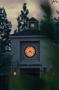
Rancho Murieta - Photo 1
Photo by Mahavir Shah
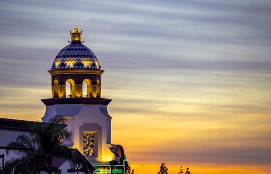
Rancho Murieta - Photo 2
Photo by Soly Moses

Rancho Murieta - Photo 3
Photo by Josh Withers
Rancho Murieta, United States
Click any image to view larger versionPast Weather Alerts
5 of 52Lake Wind Advisory
* WHAT...Southwest winds 10 to 20 mph with gusts up to 30 mph and waves 1 to 3 feet for Lake Tahoe. ...
Avalanche Warning
AVWREV The following message is transmitted at the request of the U.S. Forest Service Sierra Avalan...
Wind Advisory
* WHAT...Southwest winds of 20 to 30 mph with gusts to 40 to 50 mph for Sierra communities at lake l...
Cold Weather Advisory
* WHAT...Very cold temperatures in the teens to low 20s expected, with isolated areas in the single ...
Freeze Warning
* WHAT...Sub-freezing temperatures of 28 to 32 degrees expected. * WHERE...Carquinez Strait and Del...
Past Weather Alerts for Rancho Murieta
Lake Wind Advisory
* WHAT...Southwest winds 10 to 20 mph with gusts up to 30 mph and waves 1 to 3 feet for Lake Tahoe. Waves highest from mid-lake to eastern shores. * WHERE...Greater Lake Tahoe Area. * WHEN...From 11 AM to 10 PM PDT Monday. * IMPACTS...Small boats, kayaks and paddle boards will be prone to capsizing and should remain off lake waters until conditions improve.
Avalanche Warning
AVWREV The following message is transmitted at the request of the U.S. Forest Service Sierra Avalanche Center. BACKCOUNTRY AVALANCHE WARNING IMMEDIATE BROADCAST REQUESTED 05:30 PST Tue Feb 24 2026 The Sierra Avalanche Center in Truckee has issued a BACKCOUNTRY AVALANCHE WARNING for the following areas: NWS Reno NV - NVZ002 (Greater Lake Tahoe)...CAZ072 (Greater Lake Tahoe (CA)) * WHAT...HIGH avalanche danger exists in the backcountry. Large avalanches are expected across backcountry terrain. * WHERE...Central Sierra Nevada Mountains between Yuba Pass (Hwy 49) on the north and Ebbetts Pass (Hwy 4) on the south, including the greater Lake Tahoe area. This applies only to backcountry areas, not to ski areas and highways where avalanche mitigation programs exist. * WHEN...In effect from Tue 05:30 PST to Wed 07:00 PST. * IMPACTS...Significant rain on snow at all elevations will create widespread dangerous avalanche conditions in the mountains. Large avalanches capable of burying or injuring people are very likely in backcountry areas. Avalanches could travel farther downslope than usual and may run into areas traditionally thought of as safe. Natural avalanches are likely, and human-triggered avalanches are very likely. * PRECAUTIONARY / PREPAREDNESS ACTIONS...Very dangerous avalanche conditions exist in the backcountry. Traveling in, near, or below backcountry avalanche terrain is not recommended during HIGH avalanche danger. Consult https://www.sierraavalanchecenter.org/ or www.avalanche.org for more detailed information. Similar avalanche danger may exist at locations outside the coverage area of this or any avalanche center.
Wind Advisory
* WHAT...Southwest winds of 20 to 30 mph with gusts to 40 to 50 mph for Sierra communities at lake level and along Highway 395; and up to 50 to 65 mph near wind prone areas in Mono County. Winds of 30 to 40 mph with gusts up to 90 to 100 mph at the Sierra crest. Wave heights of 2 to 5 feet at Lake Tahoe. * WHERE...Greater Lake Tahoe Area and Mono County. * WHEN...Until 7 PM PST this evening. * IMPACTS...Gusty winds will blow around unsecured objects. Tree limbs could be blown down and a few power outages may result. Small boats, kayaks and paddle boards will be prone to capsizing and should remain off lake waters until conditions improve. * ADDITIONAL DETAILS...The strongest winds are expected late this morning into this afternoon.
Cold Weather Advisory
* WHAT...Very cold temperatures in the teens to low 20s expected, with isolated areas in the single digits above 7000 feet. * WHERE...West Slope Northern Sierra Nevada and Western Plumas County/Lassen Park. * WHEN...From 10 PM this evening to 10 AM PST Saturday. * IMPACTS...Very cold temperatures can lead to hypothermia and frostbite with prolonged exposure. This will especially impact those without power from the recent storm.
Freeze Warning
* WHAT...Sub-freezing temperatures of 28 to 32 degrees expected. * WHERE...Carquinez Strait and Delta and Northern San Joaquin Valley. * WHEN...From midnight tonight to 9 AM PST Friday. * IMPACTS...Frost and freeze conditions could kill crops and other sensitive vegetation.
Cold Weather Advisory
* WHAT...Sub-freezing temperatures between 20 and 32 degrees, coldest in the northern Sacramento Valley. * WHERE...Sacramento Valley. * WHEN...From midnight tonight to 9 AM PST Friday. * IMPACTS...Frostbite and hypothermia will occur if unprotected skin is exposed to these temperatures. Frost and freeze conditions could kill crops and other sensitive vegetation.
Cold Weather Advisory
* WHAT...Sub-freezing temperatures in the single digits to teens in the mountains with 20s to around 30 degrees in the foothills. * WHERE...Burney Basin / Eastern Shasta County, Motherlode, Mountains Southwestern Shasta County to Western Colusa County, Northeast Foothills, Shasta Lake Area / Northern Shasta County, West Slope Northern Sierra Nevada, and Western Plumas County/Lassen Park. * WHEN...From midnight tonight to 9 AM PST Friday. * IMPACTS...Very cold temperatures can lead to frostbite and hypothermia with prolonged exposure. This will especially impact those without power from the storm.
Freeze Warning
* WHAT...Sub-freezing temperatures between 20 and 32 degrees, coldest in the northern Sacramento Valley. * WHERE...Sacramento Valley. * WHEN...From midnight tonight to 9 AM PST Friday. * IMPACTS...Frostbite and hypothermia will occur if unprotected skin is exposed to these temperatures. Frost and freeze conditions could kill crops and other sensitive vegetation.
Avalanche Warning
AVWREV The following message is transmitted at the request of the U.S. Forest Service Sierra Avalanche Center. The Sierra Avalanche Center in Truckee has issued a BACKCOUNTRY AVALANCHE WARNING for the following areas: NWS Reno NV - NVZ002 (Greater Lake Tahoe)...CAZ072 (Greater Lake Tahoe (CA)) * WHAT...HIGH avalanche danger exists in the backcountry. Large avalanches are expected across backcountry terrain. * WHERE...Central Sierra Nevada Mountains between Yuba Pass (Hwy 49) on the north and Ebbetts Pass (Hwy 4) on the south, including the greater Lake Tahoe area. This does not include ski areas or highways where avalanche mitigation programs exist. * WHEN...In effect until Friday 5 AM PST. * IMPACTS...Rapidly accumulating snowfall, weak layers in the existing snowpack, and gale-force winds that blow and drift snow have created dangerous avalanche conditions in the mountains. Natural avalanches are likely, and human-triggered avalanches large enough to bury or injure people are very likely. * PRECAUTIONARY / PREPAREDNESS ACTIONS...Traveling in, near, or below backcountry avalanche terrain is not recommended during HIGH avalanche danger. Consult https://www.sierraavalanchecenter.org/ or www.avalanche.org for more detailed information. Similar avalanche danger may exist at locations outside the coverage area of this or any avalanche center.
Wind Advisory
* WHAT...South winds 10 to 20 mph with gusts of 35 to 45 mph expected. * WHERE...Carquinez Strait and Delta and Northern San Joaquin Valley. * WHEN...Until 10 PM PST this evening. * IMPACTS...Gusty winds will blow around unsecured objects. Tree limbs could be blown down and a few power outages may result. * ADDITIONAL DETAILS...Strongest winds will follow ongoing precipitation during the morning hours. A few gusts up to 50 mph can't be ruled out.
Wind Advisory
* WHAT...South winds 10 to 20 mph with gusts of 35 to 45 mph expected. * WHERE...Sacramento Valley. * WHEN...Until 10 PM PST this evening. * IMPACTS...Strongest winds will follow ongoing precipitation during the morning hours. A few gusts up to 50 mph can't be ruled out in the southern Sacramento Valley. * ADDITIONAL DETAILS...Strongest winds will be along and behind precipitation during the morning hours.
Wind Advisory
* WHAT...South winds 10 to 20 mph with gusts of 35 to 45 mph expected. * WHERE...Central Sacramento Valley, Northern Sacramento Valley, and Southern Sacramento Valley. * WHEN...Until 10 PM PST Thursday. * IMPACTS...Gusty winds will blow around unsecured objects. Tree limbs could be blown down and a few power outages may result. * ADDITIONAL DETAILS...Another round of gusty winds arrives late today and continues into Thursday.
Winter Storm Warning
* WHAT...Heavy snow with additional snow accumulations up to 1 foot between 1000 and 3000 feet, 2 to 3 feet above 3000 feet, and up to 4 feet at peaks. Light snowfall accumulations up to 2 inches below 1000 feet in Shasta and Tehama Counties. Winds gusting as high 45 to 55 mph. * WHERE...Portions of Northern California, now including elevations below 1000 ft in Shasta and Tehama Counties * WHEN...Until 10 PM PST Thursday. * IMPACTS...Dangerous to near impossible travel conditions with chain controls and road closures. Additional power outages from downed trees and power lines. Low visibility due to a combination of gusty wind and heavy snow. * ADDITIONAL DETAILS...Snow levels remain around 1500 to 2500 feet through Thursday in the Sierra Foothills with potential to see snow levels as low as 1000 feet. Snow levels potentially down to 300 feet along the southern Cascades, Shasta County, and Tehama County in the morning hours.
Winter Weather Advisory
* WHAT...Snow. Snow accumulations of 8 to 12 inches in the Tahoe Basin, with 12 to 18 inches above 7000 feet. Winds gusting as high as 45 mph. * WHERE...Greater Lake Tahoe Area. * WHEN...From 4 AM to 10 PM PST Thursday. * IMPACTS...Roads, and especially bridges and overpasses, will likely become slick and hazardous. Travel could be very difficult to impossible. The hazardous conditions could impact the Thursday morning and evening commutes. * ADDITIONAL DETAILS...Blowing snow may produce limited visibility and near whiteout conditions at times.
Winter Weather Advisory
* WHAT...Heavy snow. Lingering snow showers through the remainder of today with up to 4 inches of additional snow, mainly along the crest. Winds gusting up to 50 mph along Sierra ridgetops. For the Winter Weather Advisory, up to 6 inches on the east shore, 6 to 10 inches on the west shore, and up to 18 inches at the crest. * WHERE...Greater Lake Tahoe Area. * WHEN...For the Winter Storm Warning, until 7 AM PST this morning. For the Winter Weather Advisory, from 4 AM to 10 PM PST Thursday. * IMPACTS...Travel could be very difficult to impossible. The hazardous conditions could impact the Wednesday morning and evening commutes. Gusty winds could bring down tree branches.
Wind Advisory
* WHAT...South winds 15 to 25 mph with gusts of 35 to 45 mph expected. * WHERE...Sacramento Valley. * WHEN...Until 10 PM PST Thursday. * IMPACTS...Gusty winds will blow around unsecured objects. Tree limbs could be blown down and a few power outages may result. * ADDITIONAL DETAILS...A brief lull in stronger winds is expected on Wednesday, with another round of gusty winds late Wednesday into Thursday.
Winter Storm Warning
* WHAT...Heavy snow with additional snow accumulations up to 1 foot between 1000 and 3000 feet, 2 to 3 feet above 3000 feet, and up to 4 feet at peaks. Light snowfall accumulations up to an inch below 1000 feet in Shasta County. Winds gusting as high 45 to 55 mph. * WHERE...West Slope Northern Sierra Nevada and adjacent foothills, Western Plumas County/Lassen Park, Shasta County, including the city of Redding, and the Coastal Range. * WHEN...Until 10 PM PST Thursday. * IMPACTS...Dangerous to near impossible travel conditions with chain controls and road closures. Low visibility due to a combination of gusty wind and heavy snow. * ADDITIONAL DETAILS...Snow levels remain around 1500 to 2500 feet through Thursday. Potential to see snow levels as low as 1000 feet along the Sierra and below 1000 feet along the southern Cascades and Shasta County in the morning hours. A brief lull in activity is expected during the day on Wednesday.
Dense Fog Advisory
* WHAT...Visibility one quarter mile or less in dense fog. * WHERE...Carquinez Strait and Delta, Central/Southern Sacramento Valley, Northern San Joaquin Valley. * WHEN...From 11 PM this evening to noon PST Sunday. * IMPACTS...Low visibility could make driving conditions hazardous.
Dense Fog Advisory
* WHAT...Visibility one quarter mile or less in dense fog. * WHERE...Carquinez Strait and Delta, Central/Southern Sacramento Valley, and Northern San Joaquin Valley. * WHEN...From midnight tonight to noon PST Friday. * IMPACTS...Low visibility could make driving conditions hazardous.
Dense Fog Advisory
* WHAT...Visibility one quarter mile or less in dense fog. * WHERE...Central Sacramento Valley, Southern Sacramento Valley, and Northern San Joaquin Valley. * WHEN...From midnight tonight to noon PST Thursday. * IMPACTS...Low visibility could make driving conditions hazardous.
Dense Fog Advisory
* WHAT...Visibility one quarter mile or less in dense fog. * WHERE...Carquinez Strait and Delta, Central Sacramento Valley, Northern San Joaquin Valley, and Southern Sacramento Valley. * WHEN...Until 10 AM PST Saturday. * IMPACTS...Low visibility could make driving conditions hazardous during the evening commute and the Saturday morning commute. * ADDITIONAL DETAILS...Dangerous driving conditions with visibilities lower than 500 feet at times.
Dense Fog Advisory
* WHAT...Visibility one quarter mile or less in dense fog. * WHERE...Carquinez Strait and Delta, Central and Southern Sacramento Valley, and Northern San Joaquin Valley. * WHEN...Until noon PST Monday. * IMPACTS...Low visibility could make driving conditions hazardous.
Dense Fog Advisory
* WHAT...Visibility one quarter mile or less in dense fog. * WHERE...Carquinez Strait and Delta, Central Sacramento Valley, Northern San Joaquin Valley, and Southern Sacramento Valley. * WHEN...Until noon PST today. * IMPACTS...Low visibility could make driving conditions hazardous.
Winter Storm Warning
* WHAT...Moderate to heavy snow. Additional snow accumulations of 4 to 8 inches south of Interstate 80. For areas north of Interstate 80, 2 to 6 inches above 4500 feet, 8 to 24 inches above 5000 feet, and 1 to 3 feet above 6000 feet. Southwest wind gusts of up to 40 mph. * WHERE...West Slope Northern Sierra Nevada and Western Plumas County/Lassen Park above 5000 feet. * WHEN...Until 4 PM PST Monday. * IMPACTS...Travel could be very difficult to impossible. The hazardous conditions could impact the Monday morning commute. * ADDITIONAL DETAILS...Snow levels around 4500 to 5500 feet on Monday. Heaviest snowfall expected north of Interstate 80.
Flood Watch
* WHAT...Flooding caused by excessive rainfall continues to be possible. Additional rainfall of 0.75 to 3 inches is expected below 4000 ft, highest amounts expected over the mountains of Shasta County. * WHERE...A portion of northern California, including the following areas, Northern and Central Sacramento Valley, Mountains Southwestern Shasta County to Western Colusa County, Northeast Foothills and Shasta Lake Area / Northern Shasta County below 4000 feet. * WHEN...Through Monday afternoon. * IMPACTS...Excessive runoff may result in flooding of rivers, creeks, streams, and other low-lying and flood-prone locations. Creeks and streams may rise out of their banks. Flooding may occur in poor drainage and urban areas. Low-water crossings may be flooded. * ADDITIONAL DETAILS... - http://www.weather.gov/safety/flood
Flood Watch
An Atmospheric River Event will bring moderate to heavy rain this weekend through Monday evening. The prolonged period of rain will bring the risk of flooding to the Sacramento Valley, Shasta County, northern Sierra Nevada and adjacent foothills, as well as the Coastal Range. This will be for elevations below 4000 feet. * WHAT...Flooding caused by excessive rainfall continues to be possible. * WHERE...A portion of northern California below 4000 feet in elevation, including the following areas, Sacramento Valley, Motherlode, Mountains Southwestern Shasta County to Western Colusa County, Northeast foothills, and Shasta Lake Area / Northern Shasta County. * WHEN...Through Monday afternoon. * IMPACTS...Excessive runoff will result in rises along area rivers, creeks, streams. Small streams and creeks may rise out of their banks. Flooding may occur in low-lying, poor drainage, and urban areas. Mudslides and rockslides may occur in mountain and foothill areas. * ADDITIONAL DETAILS... - http://www.weather.gov/safety/flood
Winter Weather Advisory
* WHAT...Snow. Additional snow accumulations up to 3 to 6 inches. * WHERE...West Slope Northern Sierra Nevada County. * WHEN...Until 4 PM PST this afternoon. * IMPACTS...The hazardous conditions could impact the Monday morning commute. * ADDITIONAL DETAILS...Snow levels around 4500 to 5500 feet today. Heaviest snowfall expected north of Interstate 80.
Winter Storm Warning
* WHAT...Heavy snow. Additional snow accumulations of 1 to 2 feet above 7000 feet with up to 3 feet locally on highest peaks. Snow accumulations of 4 to 12 inches at lake level with up to 16 inches for communities along and west of Highway 89. Wind gusts of 25 to 40 mph with ridgetop winds gusting over 70 mph at times. Wind gusts up to 40 mph and wave heights of 1 to 3 feet on Lake Tahoe. * WHERE...Greater Lake Tahoe Area. * WHEN...Until 10 AM PST Monday. * IMPACTS...Travel could be very difficult to impossible. The hazardous conditions will impact weekend travel and the Monday morning commute in and across the Sierra. Strong winds could cause damage to trees and power lines.
Winter Storm Warning
* WHAT...Snow. Additional snow accumulations of 1 to 4 inches above 7000 feet. Additional snow accumulations of a trace to 2 inches at lake level. Wind gusts up to 35 mph with ridgetop winds gusting up to 80 mph. Wind gusts up to 35 mph and wave heights of 1 to 4 feet on Lake Tahoe. * WHERE...Greater Lake Tahoe Area. * WHEN...Until 10 AM PST Monday. * IMPACTS...Travel could be difficult. The hazardous conditions will impact the morning commute. Strong winds could cause damage to trees and power lines. Small boats, kayaks and paddle boards will be prone to capsizing and should remain off lake waters until conditions improve.
Winter Storm Warning
* WHAT...Heavy snow expected above 5000 feet. Additional snow accumulations of 4 to 8 inches above 4500 feet. 1 to 2 feet above 5000 feet, and 2 to 4 feet above 6000 feet. Locally higher amounts over the highest peaks. Winds gusting as high as 55 mph. * WHERE...West Slope Northern Sierra Nevada and Western Plumas County/Lassen Park above 5000 feet. * WHEN...Until 4 PM PST Monday. * IMPACTS...Travel could be very difficult to impossible. The hazardous conditions could impact weekend travel and the Monday morning commute. Strong winds could cause tree damage. * ADDITIONAL DETAILS...Snow levels around 5000 to 6000 on Sunday, lowering further to around 4000 to 5000 feet by early Monday morning. Heaviest snow expected on Sunday.
Flood Watch
* WHAT...Flooding caused by excessive rainfall continues to be possible. Additional rainfall of 1 to 3 inches is expected below 4000 ft, highest in the foothills. * WHERE...A portion of northern California below 4000 feet in elevation, including the following areas, Sacramento Valley, Motherlode, Mountains Southwestern Shasta County to Western Colusa County, Northeast foothills, and Shasta Lake Area / Northern Shasta County. * WHEN...Through Monday afternoon. * IMPACTS...Excessive runoff will result in rises along area rivers, creeks, streams. Small streams and creeks may rise out of their banks. Flooding may occur in low-lying, poor drainage, and urban areas. Mudslides and rockslides may occur in mountain and foothill areas. * ADDITIONAL DETAILS... - http://www.weather.gov/safety/flood
Winter Storm Warning
* WHAT...Heavy snow expected. Total snow accumulations of 6 to 10 inches above 4500 feet. 1 to 3 feet above 5000 feet, and 3 to 5 feet above 6000 feet. Locally higher amounts at highest peaks. Winds gusting as high as 55 mph. * WHERE...West Slope Northern Sierra Nevada and Western Plumas County/Lassen Park Counties. * WHEN...Until 4 PM PST Monday. * IMPACTS...Travel could be very difficult to impossible. The hazardous conditions could impact this evening through Monday morning commutes. Strong winds could cause tree damage. * ADDITIONAL DETAILS...Snow levels will continue to lower to 5000 to 6000 feet this afternoon and Sunday, and further to around 4500 to 5000 feet by early Monday morning. Heaviest snow expected on Sunday.
Flood Advisory
* WHAT...Flooding caused by excessive rainfall continues. * WHERE...Portions of central and northern California, including the following counties, in central California, Placer. In northern California, Amador, Calaveras, El Dorado, Nevada, Sacramento, San Joaquin, Solano, Sutter and Yolo. * WHEN...Until 300 PM PST. * IMPACTS...Minor flooding in low-lying and poor drainage areas. Water over roadways. Ponding of water in urban or other areas is occurring or is imminent. * ADDITIONAL DETAILS... - At 1009 AM PST, Doppler radar indicated heavy rain. Overflowing poor drainage areas will cause minor flooding in the advisory area. Between 0.5 and 2 inches of rain have fallen. - Some locations that will experience flooding include... Sacramento, Stockton, Elk Grove, Roseville, Citrus Heights, Folsom, Davis, Rocklin, Woodland, Galt, Auburn, Placerville, Jackson, Fair Oaks, Carmichael, El Dorado Hills, Cameron Park, Paloma, Rancho Cordova and Lodi. - http://www.weather.gov/safety/flood
Winter Storm Warning
* WHAT...Heavy snow. Additional snow accumulations of 1 to 2 feet above 7000 feet with up to 3 feet locally on highest peaks. Snow accumulations of 4 to 12 inches at lake level with up to 16 inches for communities along and west of Highway 89. Wind gusts of 35 to 45 mph with ridgetop winds gusting over 100 mph at times. Wind gusts up to 40 mph and wave heights of 1 to 3 feet on Lake Tahoe. * WHERE...Greater Lake Tahoe Area. * WHEN...Until 10 AM PST Monday. * IMPACTS...Travel could be very difficult to impossible. The hazardous conditions will impact weekend travel and the Monday morning commute in and across the Sierra. Strong winds could cause damage to trees and power lines.
Avalanche Watch
AVAREV The following message is transmitted at the request of the U.S. Forest Service Sierra Avalanche Center. The Sierra Avalanche Center in Truckee has issued a BACKCOUNTRY AVALANCHE WATCH for the following areas: NWS Reno NV - NVZ002 (Greater Lake Tahoe)...CAZ072 (Greater Lake Tahoe (CA)) * WHAT...HIGH avalanche danger may occur in the backcountry starting late Saturday afternoon or evening, potentially lasting through Sunday night. * WHERE...Central Sierra Nevada Mountains between Yuba Pass (Hwy 49) on the north and Ebbetts Pass (Hwy 4) on the south, including the greater Lake Tahoe area. This applies only backcountry areas, not to ski areas and highways where avalanche mitigation programs exist. * WHEN...In effect from Sat 15:00 PST to Sun 05:00 PST. * IMPACTS...A powerful storm with rapidly accumulating snowfall and strong winds may cause widespread avalanche activity in the mountains. Large avalanches capable of burying or injuring people could occur in backcountry areas. * PRECAUTIONARY / PREPAREDNESS ACTIONS...Very dangerous avalanche conditions could occur in the backcountry. Traveling in, near, or below backcountry avalanche terrain during HIGH avalanche danger is not recommended. Consult https://www.sierraavalanchecenter.org/ or www.avalanche.org for more detailed information. Similar avalanche danger may exist at locations outside the coverage area of this or any avalanche center.
Avalanche Watch
AVAREV The following message is transmitted at the request of the Eastern Sierra Avalanche Center. BACKCOUNTRY AVALANCHE WATCH IMMEDIATE BROADCAST REQUESTED 07:00 PST Sat Jan 03 2026 The Eastern Sierra Avalanche Center in Mammoth Lakes has issued a BACKCOUNTRY AVALANCHE WATCH for the following areas: NWS Las Vegas NV - CA-519 (Eastern Sierra in Inyo County) NWS Reno NV - CA-073 (Eastern Sierra in Mono County) * WHAT...The avalanche danger is expected to rise to HIGH through today. Dangerous avalanche conditions are expected to continue into tomorrow. * WHERE...The eastern slopes of the Sierra Nevada mountain range between Virginia Lakes to the north and Bishop Creek to the south. * WHEN...In effect from Sat 07:00 PST to Sun 07:00 PST. * IMPACTS...Heavy snowfall combined with strong to extreme winds will likely create widespread areas of unstable snow. * PRECAUTIONARY / PREPAREDNESS ACTIONS...Very dangerous avalanche conditions are expected to develop within the next 24 hours. Avalanches may run long distances, into mature forests, valley floors, or flat terrain. Consult http://www.esavalanche.org/ or www.avalanche.org for more detailed information. Similar avalanche danger may exist at locations outside the coverage area of this or any avalanche center.
Flood Advisory
* WHAT...Urban and small stream flooding caused by excessive rainfall with thunderstorms is expected. * WHERE...A portion of northern California, including the following counties, Amador, Calaveras, El Dorado, Sacramento, San Joaquin, Stanislaus and Tuolumne. * WHEN...Until 1100 PM PST. * IMPACTS...Minor flooding in low-lying and poor drainage areas. Risk of mud and rock slides in the foothills. * ADDITIONAL DETAILS... - At 512 PM PST, Local law enforcement reported flooded roadways from heavy rain due to thunderstorms. Expect urban and small stream flooding in the advisory area. Between 0.25 and 1 inch of rain has fallen in the past 3 hours. - Some locations that will experience flooding include...Stockton, Modesto, Folsom, Turlock, Ceres, Galt, Oakdale, Placerville, Sonora, Jackson, Paloma, San Andreas, Cameron Park, El Dorado Hills, Manteca, Lodi, Riverbank, Lathrop, Ripon and Waterford. - http://www.weather.gov/safety/flood
Flood Advisory
* WHAT...Urban and small stream flooding caused by excessive rainfall continues. * WHERE...A portion of northern California, including the following counties, Amador, Calaveras, El Dorado, Sacramento, San Joaquin, Stanislaus and Tuolumne. * WHEN...Until 1100 PM PST. * IMPACTS...Minor flooding in low-lying and poor drainage areas. Risk of mud and rock slides in the foothills. * ADDITIONAL DETAILS... - At 731 PM PST, Doppler radar and automated rain gauges indicated heavy rain. This will cause urban and small stream flooding. Between 0.5 and 1.25 inches of rain have fallen in the past 6 hours. - Some locations that will experience flooding include...Oakdale, Placerville, Sonora, Jackson, San Andreas, Paloma, Cameron Park, El Dorado Hills, Waterford, Ione, Rancho Murieta, Valley Springs, Angels City, Campo Seco, Rancho Calaveras, Hodson, Mountain Ranch, Clinton, Glencoe and Milton. - http://www.weather.gov/safety/flood
Wind Advisory
* WHAT...South winds 15 to 25 mph with gusts 35 to 45 mph expected. * WHERE...Northern / Central Sacramento Valley and Northeast Foothills. * WHEN...From 10 PM this evening to 4 AM PST Sunday. * IMPACTS...Gusty winds will blow around unsecured objects and winter decorations. Tree limbs could be blown down and a few power outages may result. * ADDITIONAL DETAILS...Strongest winds are generally expected from Chico northward.
Winter Storm Warning
* WHAT...Heavy snow expected above 5000 feet. Total snow accumulations of 1 to 2 feet above 5000 feet, with 2 to 5 feet above 6000 feet. Locally higher amounts at highest peaks. Winds gusting as high as 55 mph. * WHERE...West Slope Northern Sierra Nevada and Western Plumas County/Lassen Park Counties. * WHEN...From 10 PM this evening to 4 PM PST Monday. * IMPACTS...Travel could be very difficult to impossible. The hazardous conditions could impact this evening through Monday morning commutes. Strong winds could cause tree damage. * ADDITIONAL DETAILS...Snow levels 6500-7500 feet tonight into Saturday morning, lowering to 5000 to 6000 feet Saturday afternoon into Sunday, and further to around 4500 to 5500 feet by early Monday morning. Heaviest snow expected on Sunday.
Flood Watch
An Atmospheric River Event will bring moderate to heavy rain this evening through Monday evening. The prolonged period of rain will bring the risk of flooding to the Sacramento Valley, Shasta County, northern Sierra Nevada and adjacent foothills, as well as the Coastal Range. This will be for elevations below 4000 feet. * WHAT...Flooding caused by excessive rainfall is possible. * WHERE...A portion of northern California below 4000 feet in elevation, including the following areas, Sacramento Valley, Motherlode, Mountains Southwestern Shasta County to Western Colusa County, Northeast Foothills, and Shasta Lake Area / Northern Shasta County. * WHEN...From this evening through Monday afternoon. * IMPACTS...Excessive runoff will result in rises along area rivers, creeks, streams. Small streams and creeks may rise out of their banks. Flooding may occur in low-lying, poor drainage, and urban areas. Mudslides and rockslides may occur in mountain and foothill areas. * ADDITIONAL DETAILS... - http://www.weather.gov/safety/flood
Winter Storm Warning
* WHAT...Heavy snow. Snow accumulations of 1 to 3 feet above 7000 feet with 4 to 12 inches at lake level. Wind gusts of 35 to 45 mph with ridgetop winds gusting over 100 mph at times. Wind gusts up to 40 mph and wave heights of 1 to 3 feet on Lake Tahoe. * WHERE...Greater Lake Tahoe Area. * WHEN...From midnight tonight to 10 AM PST Monday. * IMPACTS...Travel could be very difficult to impossible. The hazardous conditions will impact weekend travel and the Monday morning commute in and across the Sierra. Strong winds could cause damage to trees and power lines.