San Jose
Current Weather
Scattered Clouds
Feels like: 28.3°C (82.9°F)
Sun Schedule
⚠️ Live forecasts now on mobile app only
This page is showing cached weather data. For real-time forecasts and updates for all cities, please download our mobile app:
City Images
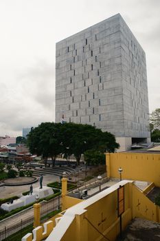
San Jose - Photo 1
Photo by Mario Spencer
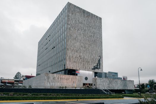
San Jose - Photo 2
Photo by Mario Spencer

San Jose - Photo 3
Photo by Hassan Pasha
San Jose, United States
Click any image to view larger versionPast Weather Alerts
5 of 206Beach Hazards Statement
* WHAT...An increased risk of sneaker waves and strong rip currents expected. * WHERE...Pacific Coa...
Beach Hazards Statement
* WHAT...Increased risk of sneaker waves and strong rip currents due to long period southwesterly sw...
Beach Hazards Statement
* WHAT...Increased risk of sneaker waves and strong rip currents due to incoming long period northwe...
Beach Hazards Statement
* WHAT...Strong northwest winds will generate very rough seas including strong rip currents at area ...
Red Flag Warning
* Winds...North winds 20 to 30 mph. Gusts 35 to 45 mph, locally up to 50 mph around the Delta and th...
Past Weather Alerts for San Jose
Beach Hazards Statement
* WHAT...An increased risk of sneaker waves and strong rip currents expected. * WHERE...Pacific Coast beaches. * WHEN...Through Wednesday afternoon. * IMPACTS...Dangerous swimming and surfing conditions and localized beach erosion can be expected. Sneaker waves can sweep across the shoreline without warning, pulling people into the sea from rocks, jetties and beaches.
Beach Hazards Statement
* WHAT...Increased risk of sneaker waves and strong rip currents due to long period southwesterly swell. * WHERE...Beaches along the Pacific Coast, especially southwest facing beaches. * WHEN...From late tonight through Saturday morning. * IMPACTS...Dangerous swimming and surfing conditions and localized beach erosion can be expected. Sneaker waves can sweep across the shoreline without warning, pulling people into the sea from rocks, jetties and beaches.
Beach Hazards Statement
* WHAT...Increased risk of sneaker waves and strong rip currents due to incoming long period northwesterly swell. * WHERE...Beaches along the Pacific Coast. * WHEN...Until 3 AM PDT Friday. * IMPACTS...Dangerous swimming and surfing conditions and localized beach erosion can be expected. Sneaker waves can sweep across the shoreline without warning, pulling people into the sea from rocks, jetties and beaches.
Beach Hazards Statement
* WHAT...Strong northwest winds will generate very rough seas including strong rip currents at area beaches. * WHERE...Pacific Coast beaches. * WHEN...Now through 9 am Wednesday morning. * IMPACTS...Dangerous conditions are forecast along the shoreline. Hazards include strong rip currents and large breaking waves.
Red Flag Warning
* Winds...North winds 20 to 30 mph. Gusts 35 to 45 mph, locally up to 50 mph around the Delta and the western Sacramento Valley. * Humidity...Daytime minimum humidities of 7 to 15%. Overnight maximum relative humidities of 20 to 45%. * Highest Threat...Along and west of the Interstate 5 corridor in the Sacramento Valley. Strongest winds are expected today. * Impacts...The combination of gusty winds and low humidity can cause fire to rapidly grow in size and intensity. Outdoor burning is not recommended.
Wind Advisory
* WHAT...North to northeast winds 15 to 30 mph with gusts up to 50 mph expected. Local gusts up to 60 mph. * WHERE...The Santa Cruz Mountains, North Bay Interior Mountains, Eastern Santa Clara Hills, and East Bay Hills. * WHEN...Until 11 AM PDT Monday. * IMPACTS...Gusty winds will blow around unsecured objects. Tree limbs could be blown down and a few power outages may result.
Beach Hazards Statement
* WHAT...Strong northerly winds will generate very rough conditions at area beaches along with strong rip and longshore currents. * WHERE...Greatest impacts will be along west facing beaches of the Pacific coastline. * WHEN...Until 9 AM PDT Monday. * IMPACTS...Dangerous wind and wave conditions will impact beaches and water activities such as swimming, surfing, boating, and tide pooling. Rough seas can sweep up the beach and over rocks and jetties, pulling people into a cold turbulent ocean. Rip currents will be stronger than normal and long shore currents can move people and items in the water quickly away from the point of entry. Local beach and cliff erosion is possible. Water temperatures will also cool rapidly due to strong upwelling conditions during this time. Large tidal swings can cutoff access to beach walkers.
Beach Hazards Statement
* WHAT...An incoming long-period northwesterly swell will increase the risk of sneaker waves and strong rip currents. * WHERE...Beaches along the Pacific Coast. * WHEN...Now through Sunday evening. * IMPACTS...Dangerous swimming and surfing conditions and localized beach erosion can be expected. Sneaker waves can sweep across the shoreline without warning, pulling people into the sea from rocks, jetties and beaches.
Heat Advisory
* WHAT...High temperatures in the low to mid 90s across the interior and 80s along the coastline. * WHERE...The Bay Area and Central Coast. * WHEN...Until 8 PM PDT Friday. * IMPACTS...This level of heat affects most individuals sensitive to heat, especially those without effective cooling and/or adequate hydration. Impacts possible in some health systems and in heat-sensitive industries. Hot conditions can cause heat illnesses. * ADDITIONAL DETAILS...Much above normal temperatures in the upper 80s to mid 90s are expected through the remainder of the week across the Bay Area and Central Coast. Portions of the interior Central Coast may reach the upper 90s starting mid to late week. Overnight lows in the upper 50s to low 60s will offer some relief to the lower elevations but will offer minimal relief within the higher elevations. Conditions will be much above normal along the coast this week but coastal residents may experience more relief overnight than those across the interior. The risk of heat related illnesses will increase with each additional day of heating from this event.
Heat Advisory
* WHAT...High temperatures in the low to mid 90s across the interior and 80s along the coastline. Reduced cooling overnight especially in the higher elevations. * WHERE...The Bay Area and Central Coast. * WHEN...Until 8 PM PDT Friday. * IMPACTS...This level of heat affects most individuals sensitive to heat, especially those without effective cooling and/or adequate hydration. Impacts possible in some health systems and in heat-sensitive industries. Hot conditions can cause heat illnesses. * ADDITIONAL DETAILS...Much above normal temperatures in the upper 80s to mid 90s are expected through the remainder of the week across the Bay Area and Central Coast. Portions of the interior Central Coast may reach the upper 90s starting mid to late week. Overnight lows in the upper 50s to low 60s will offer some relief to the lower elevations but will offer minimal relief within the higher elevations. Conditions will be much above normal along the coast this week but coastal residents may experience more relief overnight than those across the interior. The risk of heat related illnesses will increase with each additional day of heating from this event.
Cold Weather Advisory
* WHAT...Cold conditions with temperatures as low as 33 expected. Colder temperatures as low as 27 degrees for elevations above 2500 feet. * WHERE...East Bay Hills. * WHEN...From 1 AM to 9 AM PST Saturday. * IMPACTS...Cold conditions will be hazardous to sensitive populations such as unhoused individuals. Prolonged exposure to the cold conditions will lead to hypothermia for people, pets, and livestock. Cold conditions may damage or kill sensitive crops, plants, and vegetation if appropriate precautions are not taken.
Cold Weather Advisory
* WHAT...Cold conditions with temperatures as low as 33 expected. Slightly warmer conditions will be found across portions of the northern Salinas Valley and Carmel Valley where low temperatures range from 36 to 40 degrees. * WHERE...The Santa Clara Valley, North Bay Interior Valleys and Mountains, East Bay Interior Valleys, and Northern Salinas Valley and Hollister Valley. * WHEN...From 1 AM to 9 AM PST Saturday. * IMPACTS...Cold conditions will be hazardous to sensitive populations such as unhoused individuals. Prolonged exposure to the cold conditions will lead to hypothermia for people, pets, and livestock. Cold conditions may damage or kill sensitive crops, plants, and vegetation if appropriate precautions are not taken.
Extreme Cold Warning
* WHAT...Very cold conditions with temperatures as low as 31 expected. * WHERE...Interior Monterey County and the Santa Lucia Range, Most of San Benito County and the Cholame Hills in Southeast Monterey County, Eastern Santa Clara Hills, and Southern Salinas Valley/Arroyo Seco and Lake San Antonio. * WHEN...From 1 AM to 9 AM PST Saturday. * IMPACTS...Cold conditions will be hazardous to sensitive populations such as unhoused individuals. Cold conditions may damage or kill sensitive crops, plants, and vegetation if appropriate precautions are not taken. Prolonged exposure to the cold conditions will lead to hypothermia for people, pets, and livestock.
Cold Weather Advisory
* WHAT...Cold conditions with temperatures in the low-to-mid 30s expected. * WHERE...The Marin Hills, Western Sonoma County Hills, Northern Monterey Bay, The Santa Cruz Mountains, The Santa Clara Valley, Coastal North Bay Including Point Reyes National Seashore, San Francisco Bay Shoreline, and Northern Salinas Valley/Hollister Valley and Carmel Valley. * WHEN...From 1 AM to 9 AM PST Friday. * IMPACTS...Cold conditions will be hazardous to sensitive populations such as unhoused individuals. Prolonged exposure to the cold conditions will lead to hypothermia for people, pets, and livestock. Cold conditions may damage or kill sensitive crops, plants, and vegetation if appropriate precautions are not taken.
Extreme Cold Warning
* WHAT...Very cold conditions with sub-freezing temperatures in the mid-20s to low-30s expected. * WHERE...The East Bay Hills and Valleys, Interior Monterey County and the Santa Lucia Range, Most of San Benito County and the Cholame Hills in Southeast Monterey County, North Bay Interior Mountains, North Bay Interior Valleys, Eastern Santa Clara Hills, and Southern Salinas Valley/Arroyo Seco and Lake San Antonio. * WHEN...From 1 AM to 9 AM PST Friday. * IMPACTS...Cold conditions will be hazardous to sensitive populations such as unhoused individuals. Cold conditions may damage or kill sensitive crops, plants, and vegetation if appropriate precautions are not taken. Prolonged exposure to the cold conditions will lead to hypothermia for people, pets, and livestock.
High Surf Advisory
* WHAT...Large breaking waves of 18 to 22 feet, with continuing increased risk of sneaker waves and strong rip currents. * WHERE...Pacific Coast beaches. * WHEN...Until 9 AM PST Friday. * IMPACTS...Dangerous swimming and surfing conditions and localized beach erosion can be expected. Sneaker waves can sweep across the shoreline without warning, pulling people into the sea from rocks, jetties and beaches. Large breaking waves can overpower swimmers resulting in significant physical injury and increase the risk of drowning.
Winter Weather Advisory
...WINTER WEATHER ADVISORY THROUGH WEDNESDAY AFTERNOON... .Cold air will continue to move into the region today through Wednesday afternoon with accumulating snowfall expected across areas above 3000 feet in the Santa Lucia range and the mountains of San Benito and eastern Santa Clara Counties. Total snow accumulations range from 4 to 10 inches with the highest peaks reaching accumulations of 15 to 25 inches. If planning travel to the higher elevations of the Central Coast and eastern Santa Clara County, allow extra time to reach your destination safely. * WHAT...Accumulating snow for elevations above 3000 feet. Elevations below 3000 feet will see no accumulating snow to a dusting. Above 3000 feet total snow accumulations of 4 to 8 inches. * WHERE...Elevations above 3000 feet for the Santa Clara Hills. * WHEN...Until 4 PM PST Wednesday. * IMPACTS...Slick, snow-covered roads, like Hwy 130, and hiking trails. Hikers, outdoor enthusiasts may encounter dangerous winter conditions above the snow level. Heavier snow showers could produce limited visibilities. Downed trees and power outages possible. * ADDITIONAL DETAILS...Wind gusts 25 to 40 mph above 2000 feet. The combination of wind and snow will reduce visibilities.
Extreme Cold Warning
* WHAT...Very cold conditions with temperatures as low as 24 expected. * WHERE...Eastern Santa Clara Hills. * WHEN...Until 9 AM PST Wednesday. * IMPACTS...Cold conditions will be hazardous to sensitive populations such as unhoused individuals. Cold conditions may damage or kill sensitive crops, plants, and vegetation if appropriate precautions are not taken. Prolonged exposure to the cold conditions will lead to hypothermia for people, pets, and livestock. * ADDITIONAL DETAILS...Hikers, outdoor enthusiasts will encounter dangerously cold conditions over the higher peaks.
Cold Weather Advisory
* WHAT...Cold conditions with temperatures as low as 33 expected in the Santa Cruz Mountains. Cold conditions with temperatures as low as 34 expected in southern Santa Clara county and mid to upper 30s near San Jose. * WHERE...The Santa Cruz Mountains, and The Santa Clara Valley. * WHEN...Until 9 AM PST Wednesday. * IMPACTS...Cold conditions will be hazardous to sensitive populations such as unhoused individuals. Prolonged exposure to the cold conditions will lead to hypothermia for people, pets, and livestock. Cold conditions may damage or kill sensitive crops, plants, and vegetation if appropriate precautions are not taken.
Cold Weather Advisory
* WHAT...Cold conditions with temperatures as low as 33 expected in the Santa Cruz Mountains. Cold conditions with temperatures as low as 34 expected in southern Santa Clara county and mid to upper 30s near San Jose. * WHERE...The Santa Cruz Mountains, and The Santa Clara Valley. * WHEN...From midnight tonight to 9 AM PST Wednesday. * IMPACTS...Cold conditions will be hazardous to sensitive populations such as unhoused individuals. Prolonged exposure to the cold conditions will lead to hypothermia for people, pets, and livestock. Cold conditions may damage or kill sensitive crops, plants, and vegetation if appropriate precautions are not taken.
Extreme Cold Warning
* WHAT...Very cold conditions with temperatures as low as 24 expected. * WHERE...Eastern Santa Clara Hills. * WHEN...From midnight tonight to 9 AM PST Wednesday. * IMPACTS...Cold conditions will be hazardous to sensitive populations such as unhoused individuals. Cold conditions may damage or kill sensitive crops, plants, and vegetation if appropriate precautions are not taken. Prolonged exposure to the cold conditions will lead to hypothermia for people, pets, and livestock. * ADDITIONAL DETAILS...Hikers, outdoor enthusiasts will encounter dangerously cold conditions over the higher peaks.
Winter Weather Advisory
...WINTER WEATHER ADVISORY THROUGH WEDNESDAY AFTERNOON... Cold air will continue to move into the region today through Wednesday afternoon with accumulating snowfall expected across areas above 3000 feet in the Santa Lucia range and the mountains of San Benito and eastern Santa Clara Counties. Total snow accumulations range from 4 to 10 inches with the highest peaks reaching accumulations of 15 to 25 inches. If planning travel to the higher elevations of the Central Coast and eastern Santa Clara County, allow extra time to reach your destination safely. * WHAT...Accumulating snow for elevations above 3000 feet. Elevations below 3000 feet will see no accumulating snow to a dusting. Above 3000 feet total snow accumulations of 4 to 8 inches. * WHERE...Elevations above 3000 feet for the Santa Clara Hills. * WHEN...From 6 AM today to 4 PM PST Wednesday. * IMPACTS...Slick, snow-covered roads, like Hwy 130, and hiking trails. Hikers, outdoor enthusiasts may encounter dangerous winter conditions above the snow level. Heavier snow showers could produce limited visibilities. Downed trees and power outages possible. * ADDITIONAL IMPACTS...Wind gusts 25 to 40 mph above 2000 feet. The combination of wind and snow will reduce visibilities.
Beach Hazards Statement
* WHAT...An increased risk of sneaker waves and strong rip currents with breaking waves of 14 to 19 feet. * WHERE...Northwest facing Pacific Coast beaches. * WHEN...From 10 PM PST this evening through 4 AM PST Saturday. * IMPACTS...Dangerous conditions are forecast along the shoreline. Hazards include sneaker waves, strong rip currents, and large breaking waves.
Beach Hazards Statement
* WHAT...An increased risk of sneaker waves and strong rip currents with breaking waves of 14 to 19 feet. * WHERE...Northwest facing Pacific Coast beaches. * WHEN...From 10 PM PST this evening through late Friday night. * IMPACTS...Dangerous conditions are forecast along the shoreline. Hazards include sneaker waves, strong rip currents, and large breaking waves.
Beach Hazards Statement
* WHAT...An increased risk of sneaker waves and strong rip currents with breaking waves of 14 to 19 feet. * WHERE...Northwest facing Pacific Coast beaches. * WHEN...From Thursday evening through late Friday night. * IMPACTS...Dangerous conditions are forecast along the shoreline. Hazards include sneaker waves, strong rip currents, and large breaking waves.
High Surf Advisory
* WHAT...Large breaking waves of 17 to 22 feet, with continuing increased risk of sneaker waves and strong rip currents. * WHERE...Pacific Coast beaches. * WHEN...Until 9 PM PST this evening. * IMPACTS...Dangerous swimming and surfing conditions and localized beach erosion can be expected. Sneaker waves can sweep across the shoreline without warning, pulling people into the sea from rocks, jetties and beaches. Large breaking waves can overpower swimmers resulting in significant physical injury and increase the risk of drowning.
High Surf Advisory
* WHAT...Large breaking waves of 17 to 22 feet, with continuing increased risk of sneaker waves and strong rip currents. * WHERE...Pacific Coast beaches. * WHEN...Until 9 PM PST Saturday. * IMPACTS...Dangerous swimming and surfing conditions and localized beach erosion can be expected. Sneaker waves can sweep across the shoreline without warning, pulling people into the sea from rocks, jetties and beaches. Large breaking waves can overpower swimmers resulting in significant physical injury and increase the risk of drowning.
High Surf Advisory
* WHAT...For the Beach Hazards Statement, an increased risk of sneaker waves and strong rip currents with breaking waves of 14 to 19 feet expected. For the High Surf Advisory, large breaking waves of 17 to 22 feet, with a continuing increased risk of sneaker waves and strong rip currents. * WHERE...Pacific Coast beaches. * WHEN...Until 9 PM PST Saturday. * IMPACTS...Dangerous swimming and surfing conditions and localized beach erosion can be expected. Sneaker waves can sweep across the shoreline without warning, pulling people into the sea from rocks, jetties and beaches. Large breaking waves can overpower swimmers resulting in significant physical injury and increase the risk of drowning.
Beach Hazards Statement
* WHAT...For the Beach Hazards Statement, an increased risk of sneaker waves and strong rip currents with breaking waves of 14 to 19 feet expected. For the High Surf Advisory, large breaking waves of 17 to 22 feet, with a continuing increased risk of sneaker waves and strong rip currents. * WHERE...Pacific Coast beaches. * WHEN...For the Beach Hazards Statement, now through 4 AM Friday. For the High Surf Advisory, from 4 AM Friday to 9 PM PST Saturday. * IMPACTS...Dangerous swimming and surfing conditions and localized beach erosion can be expected. Sneaker waves can sweep across the shoreline without warning, pulling people into the sea from rocks, jetties and beaches. Large breaking waves can overpower swimmers resulting in significant physical injury and increase the risk of drowning. Dangerous conditions are forecast along the shoreline. Hazards include sneaker waves, strong rip currents, and large breaking waves.
High Surf Advisory
* WHAT...For the Beach Hazards Statement, an increased risk of sneaker waves and strong rip currents with breaking waves of 14 to 19 feet expected. For the High Surf Advisory, large breaking waves of 17 to 22 feet, with a continuing increased risk of sneaker waves and strong rip currents. * WHERE...Pacific Coast beaches. * WHEN...For the Beach Hazards Statement, now through 4 AM Friday. For the High Surf Advisory, from 4 AM Friday to 9 PM PST Saturday. * IMPACTS...Dangerous swimming and surfing conditions and localized beach erosion can be expected. Sneaker waves can sweep across the shoreline without warning, pulling people into the sea from rocks, jetties and beaches. Large breaking waves can overpower swimmers resulting in significant physical injury and increase the risk of drowning. Dangerous conditions are forecast along the shoreline. Hazards include sneaker waves, strong rip currents, and large breaking waves.
Beach Hazards Statement
* WHAT...For the Beach Hazards Statement, an increased risk of sneaker waves and strong rip currents with breaking waves of 14 to 19 feet expected. For the High Surf Advisory, large breaking waves of 17 to 22 feet, with a continuing increased risk of sneaker waves and strong rip currents. * WHERE...Pacific Coast beaches. * WHEN...For the Beach Hazards Statement, through late tonight. For the High Surf Advisory, from 4 AM Friday to 9 PM PST Saturday. * IMPACTS...Dangerous swimming and surfing conditions and localized beach erosion can be expected. Sneaker waves can sweep across the shoreline without warning, pulling people into the sea from rocks, jetties and beaches. Large breaking waves can overpower swimmers resulting in significant physical injury and increase the risk of drowning. Dangerous conditions are forecast along the shoreline. Hazards include sneaker waves, strong rip currents, and large breaking waves.
High Surf Advisory
* WHAT...For the Beach Hazards Statement, an increased risk of sneaker waves and strong rip currents with breaking waves of 14 to 19 feet expected. For the High Surf Advisory, large breaking waves of 17 to 22 feet, with a continuing increased risk of sneaker waves and strong rip currents. * WHERE...Pacific Coast beaches. * WHEN...For the Beach Hazards Statement, from midnight tonight through 4 AM Friday. For the High Surf Advisory, from 4 AM Friday to 9 PM PST Saturday. * IMPACTS...Dangerous swimming and surfing conditions and localized beach erosion can be expected. Sneaker waves can sweep across the shoreline without warning, pulling people into the sea from rocks, jetties and beaches. Large breaking waves can overpower swimmers resulting in significant physical injury and increase the risk of drowning. Dangerous conditions are forecast along the shoreline. Hazards include sneaker waves, strong rip currents, and large breaking waves.
Beach Hazards Statement
* WHAT...For the Beach Hazards Statement, an increased risk of sneaker waves and strong rip currents with breaking waves of 14 to 19 feet expected. For the High Surf Advisory, large breaking waves of 17 to 22 feet, with a continuing increased risk of sneaker waves and strong rip currents. * WHERE...Pacific Coast beaches. * WHEN...For the Beach Hazards Statement, from midnight tonight through 4 AM Friday. For the High Surf Advisory, from 4 AM Friday to 9 PM PST Saturday. * IMPACTS...Dangerous swimming and surfing conditions and localized beach erosion can be expected. Sneaker waves can sweep across the shoreline without warning, pulling people into the sea from rocks, jetties and beaches. Large breaking waves can overpower swimmers resulting in significant physical injury and increase the risk of drowning. Dangerous conditions are forecast along the shoreline. Hazards include sneaker waves, strong rip currents, and large breaking waves.
High Surf Advisory
* WHAT...For the Beach Hazards Statement, an increased risk of sneaker waves and strong rip currents with breaking waves of 14 to 19 feet expected. For the High Surf Advisory, large breaking waves of 17 to 22 feet, with a continuing increased risk of sneaker waves and strong rip currents. * WHERE...Pacific Coast beaches. * WHEN...For the Beach Hazards Statement, from late tonight through late Thursday night. For the High Surf Advisory, from 4 AM Friday to 9 PM PST Saturday. * IMPACTS...Dangerous swimming and surfing conditions and localized beach erosion can be expected. Sneaker waves can sweep across the shoreline without warning, pulling people into the sea from rocks, jetties and beaches. Large breaking waves can overpower swimmers resulting in significant physical injury and increase the risk of drowning. Dangerous conditions are forecast along the shoreline. Hazards include sneaker waves, strong rip currents, and large breaking waves.
Beach Hazards Statement
* WHAT...For the Beach Hazards Statement, an increased risk of sneaker waves and strong rip currents with breaking waves of 14 to 19 feet expected. For the High Surf Advisory, large breaking waves of 17 to 22 feet, with a continuing increased risk of sneaker waves and strong rip currents. * WHERE...Pacific Coast beaches. * WHEN...For the Beach Hazards Statement, from 12 PM PST Thursday through 4 AM Friday. For the High Surf Advisory, from 4 AM Friday to 9 PM PST Saturday. * IMPACTS...Dangerous swimming and surfing conditions and localized beach erosion can be expected. Sneaker waves can sweep across the shoreline without warning, pulling people into the sea from rocks, jetties and beaches. Large breaking waves can overpower swimmers resulting in significant physical injury and increase the risk of drowning. Strong rip currents can rapidly pull swimmers away from shore.
High Surf Advisory
* WHAT...For the Beach Hazards Statement, an increased risk of sneaker waves and strong rip currents with breaking waves of 14 to 19 feet expected. For the High Surf Advisory, large breaking waves of 17 to 22 feet, with a continuing increased risk of sneaker waves and strong rip currents. * WHERE...Pacific Coast beaches. * WHEN...For the Beach Hazards Statement, from 12 PM PST Thursday through 4 AM Friday. For the High Surf Advisory, from 4 AM Friday to 9 PM PST Saturday. * IMPACTS...Dangerous swimming and surfing conditions and localized beach erosion can be expected. Sneaker waves can sweep across the shoreline without warning, pulling people into the sea from rocks, jetties and beaches. Large breaking waves can overpower swimmers resulting in significant physical injury and increase the risk of drowning. Strong rip currents can rapidly pull swimmers away from shore.
Beach Hazards Statement
* WHAT...An increased risk of sneaker waves and strong rip currents with breaking waves of 14 to 19 feet. * WHERE...Pacific Coast beaches. * WHEN...Through 9 PM PST this evening. * IMPACTS...Dangerous conditions are forecast along the shoreline. Hazards include sneaker waves, strong rip currents, and large breaking waves.
Beach Hazards Statement
* WHAT...An increased risk of sneaker waves and strong rip currents with breaking waves of 14 to 19 feet. * WHERE...Pacific Coast beaches. * WHEN...Through 9 PM PST Monday evening. * IMPACTS...Dangerous conditions are forecast along the shoreline. Hazards include sneaker waves, strong rip currents, and large breaking waves.
Beach Hazards Statement
* WHAT...An increased risk of sneaker waves and strong rip currents with breaking waves of 14 to 19 feet. * WHERE...All beaches along the Pacific Coast from Sonoma County to Monterey County. * WHEN...Through Monday morning. * IMPACTS...Dangerous conditions are forecast along the shoreline. Hazards include sneaker waves, strong rip currents, and large breaking waves.
Coastal Flood Advisory
* WHAT...Up to 1.3 ft of inundation above ground level is possible in low-lying areas near shorelines and tidal waterways. * WHERE...Bayshore locations along the San Francisco Bay and San Pablo Bay. * WHEN...Until noon PST Sunday. * IMPACTS...Flooding of lots, parks, and roads with only isolated road closures expected. * ADDITIONAL DETAILS...At the San Francisco tidal gauge, high tide is expected to be: 1.2 ft above normal (6.96 ft MLLW) at 10:22 AM Sunday 2/1. These predictions include up to 0.3 ft of storm surge from an incoming moderate to long period swell that will enhance the astronomical tide and flooding threat. High tide timing varies up to 90 minutes earlier or later along the Pacific Coast and through the San Francisco Bay, respectively.