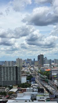
Heavy Rain
The high-pressure system from China extend to upper Thailand and the South China Sea leading to the easterly wind prevails over the Gulf, Thailand and the Andaman Sea. Variable weather are possible following with thundershowers, gust, hail and isolated heavy rains over upper Thailand. People should beware of heavy rains and severe condition by keeping off outdoor places, big trees and unsecured billboards. In the Andaman Sea and the Gulf, the waves will be higher than 2 meters high in thundershower areas.
From: Nov 05, 2026 23:00
Until: Nov 06, 2026 11:00
Heavy Rain
The high-pressure system from China covers the upper Northeast and the South China Sea while the easterly wind prevails over the Gulf, Thailand and the Andaman Sea. Thundershowers with gusty wind are forecast in Thailand while isolated heavy rain in the Central including Bangkok and vicinity, the East regions and the South.
In the Andaman Sea and the Gulf, the waves will be higher than 2 meters high in thundershower areas.
From: Nov 03, 2026 23:00
Until: Nov 04, 2026 11:00
Heavy Rain
The high-pressure system from China covers the upper North and the upper Northeast. Meanwhile the monsoon trough lies across the lower Central the upper South and the East regions with the rather strong southwest monsoon prevails over the Andaman Sea, the South and the Gulf with isolated heavy rains in the country.
The rather strong wind forces the waves in the upper Andaman Sea up to be 2-3 meters high and above 3 meters high in thundershowers. In the lower Andaman Sea and the upper Gulf, the waves are expected about 2 meters high and above 2 meters high in thundershowers.
From: Sep 19, 2026 23:00
Until: Sep 20, 2026 11:00
Heavy Rain
The monsoon trough move up to lying across the North and the Northeast of Thailand while the rather strong southwest monsoon prevailing over the Andaman Sea, Thailand and the Gulf. Isolated heavy rains are forecast in the country while isolated very heavy rain are possible in the North, the Northeast and the South (west coast) regions.
The rather strong wind forces the waves in the upper Andaman Sea up to be 2-3 meters high and above 3 meters high in thundershowers. In the lower Andaman Sea and the upper Gulf, the waves are expected about 2 meters high and above 2 meters high in thundershowers.
From: Sep 17, 2026 11:00
Until: Sep 18, 2026 01:00
Heavy Rain
ประเทศไทยมีฝนตกหนักบางแห่ง โดยมีฝนตกหนักมากบางพื้นที่บริเวณภาคเหนือ ภาคตะวันออกเฉียงเหนือ
และภาคใต้ฝั่งตะวันตก
ทั้งนี้เนื่องจากร่องมรสุมพาดผ่านหย่อมความกดอากาศต่ำที่ปกคลุมภาคเหนือและภาคตะวันออกเฉียงเหนือตอนบน ประกอบกับมรสุมตะวันตกเฉียงใต้กำลังค่อนข้างแรงพัดปกคลุมทะเลอันดามัน ประเทศไทย และอ่าวไทย
สำหรับคลื่นลมบริเวณทะเลอันดามันและอ่าวไทยมีกำลังค่อนข้างแรง โดยทะเลอันดามันตอนบนมีคลื่นสูง 2-3 เมตร บริเวณที่มีฝนฟ้าคะนองคลื่นสูงมากกว่า
3 เมตร ส่วนทะเลอันดามันตอนล่างและอ่าวไทยตอนบนมีคลื่นสูงประมาณ 2 เมตร บริเวณที่มีฝนฟ้าคะนองมีคลื่นสูงมากกว่า 2 เมตร
From: Sep 17, 2026 11:00
Until: Sep 18, 2026 01:00
Very Heavy Rain
บริเวณภาคเหนือ ภาคตะวันออกเฉียงเหนือ ภาคกลาง รวมทั้งกรุงเทพมหานครและปริมณฑล ภาคตะวันออก และภาคใต้
มีฝนตกหนักถึงฝนตกหนักมากบางพื้นที่
ทั้งนี้เนื่องจากบริเวณความกดอากาศสูงหรือมวลอากาศเย็นแผ่ลงมาปกคลุมภาคเหนือตอนบน และภาคตะวันออกเฉียงเหนือตอนบนแล้ว ส่งผลให้ร่องมรสุมเลื่อนลงมาพาดผ่านภาคเหนือตอนล่าง ภาคกลางตอนบน และภาคตะวันออกเฉียงเหนือตอนล่างเข้าสู่หย่อมความกดอากาศต่ำกำลังแรงบริเวณทะเลจีนใต้ตอนกลาง
ประกอบกับมรสุมตะวันตกเฉียงใต้กำลังปานกลางพัดปกคลุมทะเลอันดามัน ภาคใต้ ภาคกลาง ภาคตะวันออก และอ่าวไทย
สำหรับคลื่นลมบริเวณทะเลอันดามันและอ่าวไทยมีกำลังปานกลาง โดยทะเลอันดามันตอนบนมีคลื่นสูงประมาณ 2 เมตร บริเวณที่มีฝนฟ้าคะนองคลื่นสูงมากกว่า 2 เมตร
From: Sep 10, 2026 11:00
Until: Sep 10, 2026 23:00
Very Heavy Rain
The high-pressure system from China extend to the upper North and the upper Northeast of Thailand leading to the monsoon trough move down to lies across the lower North, the upper Central and the lower Northeast into an active low-pressure cell over the middle South China Sea. Meanwhile, the moderate southwest monsoon prevails over the Andaman Sea, the South, the Central, the East and the Gulf. Isolated heavy rains are forecast in the country while isolated heavy to very heavy rains are possible in the North, the Northeast, the Central including Bangkok and its vicinity, the East and the South regions
The moderate winds and waves in the upper Andaman Sea are expected about 2 meters high and above 2 meters high in thundershowers.
From: Sep 10, 2026 11:00
Until: Sep 10, 2026 23:00
Heavy Rain
The monsoon trough lies across the North and the Northeast while the moderate southwest monsoon prevails over the Andaman Sea, Thailand and the Gulf. Isolated very heavy rains are forecast in the North, the East and the South (west coast) regions while isolated heavy rains are possible in the Northeast and the Central including Bangkok and its vicinity and the South (east coast). The rather strong winds forcing the waves in the upper Andaman Sea will weaken. In the Andaman Sea and the upper Gulf, waves will be up to 2 meters high and above 2 meters high in thundershowers. In the lower Andaman Sea, the waves are expected to be about 1 meter high, 1-2 meters offshore and above 2 meters high in thundershowers.
From: Jul 30, 2026 23:00
Until: Jul 31, 2026 11:00
Heavy Rain
The moderate southwest monsoon prevails over the Andaman Sea, Thailand and the Gulf while the low-pressure cell covers upper Vietnam. Thundershowers are forecast in Thailand and isolated heavy rains are possible in the Central including Bangkok and its vicinity, the East and the South(west coast). The moderate wind and waves in the upper Andaman Sea are expected about 2 meters high, 1-2 meters high in the lower Andaman Sea and the upper Gulf and above 2 meters high in thundershowers.
From: Jun 25, 2026 23:00
Until: Jun 26, 2026 11:00
Heavy Rain
The moderate southwest monsoon prevails over the Andaman Sea, Thailand and the Gulf while the low-pressure cell covers upper Vietnam with isolated heavy rains in the East, Bangkok including vicinity and the lower South regions.
The moderate wind and waves in the upper Andaman Sea are expected 1-2 meters high, about 1 meter high in the lower Andaman Sea and the Gulf and above 2 meters high in thundershowers.
From: Jun 20, 2026 23:00
Until: Jun 21, 2026 11:00
Heavy Rain
ประเทศไทยมีฝนตกหนักบางแห่ง โดยเฉพาะจังหวัดนครสวรรค์ อุทัยธานี ชัยนาท สุพรรณบุรี ลพบุรี สระบุรี เพชรบุรี ประจวบคีรีขันธ์ ชุมพร และระนอง แต่ยังคงมีอากาศเย็นในตอนเช้าบริเวณภาคเหนือ เนื่องจากหย่อมความกดอากาศต่ำที่ปกคลุมบริเวณอ่าวไทยตอนบนได้เคลื่อนตามแนวร่องมรสุมลงสู่ทะเลอันดามันตอนบนแล้ว โดยร่องมรสุมกำลังแรงยังคงพาดผ่านภาคใต้ตอนบนและอ่าวไทยตอนบน ประกอบกับมีลมตะวันออกและลมตะวันออกเฉียงใต้พัดปกคลุมภาคเหนือและภาคกลาง ในขณะที่บริเวณความกดอากาศสูงหรือมวลอากาศเย็นกำลังอ่อนปกคลุมประเทศไทยตอนบน ขอให้เกษตรกรเตรียมการป้องกันและระวังความเสียหายที่จะเกิดต่อผลผลิตทางการเกษตร รวมทั้งดูแลรักษาสุขภาพเนื่องจากสภาพอากาศที่เปลี่ยนแปลง เพิ่มความระมัดระวังในการสัญจรผ่านบริเวณที่มีฝนตก และระวังอันตรายจากฝนตกหนัก ซึ่งอาจทำให้เกิดน้ำท่วมได้ในบางพื้นที่
สำหรับคลื่นลมบริเวณอ่าวไทยตอนบนและทะเลอันดามันตอนบนมีกำลังปานกลาง โดยมีคลื่นสูง 1-2 เมตร บริเวณที่มีฝนฟ้าคะนองคลื่นสูงมากกว่า 2 เมตร อ่าวไทยตอนล่างและทะเลอันดามันตอนล่างมีคลื่นสูงประมาณ 1 เมตร บริเวณที่มีฝนฟ้าคะนองคลื่นสูงมากกว่า 2 เมตร ขอให้ชาวเรือบริเวณอ่าวไทยและทะเลอันดามันเดินเรือด้วยความระมัดระวัง และหลีกเลี่ยงการเดินเรือในบริเวณที่มีฝนฟ้าคะนอง
From: Oct 31, 2025 23:00
Until: Nov 01, 2025 11:00